News & Notes

New Resource: Help Your Community Prepare with FEMA’s Guide for Alerts and Warnings

April 5, 2022

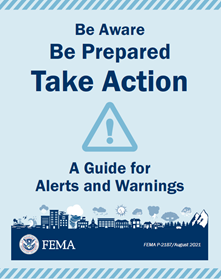
Help people learn how to respond to hazard watches and warnings with FEMA’s Guide for Alerts and Warnings, a free preparedness resource.

Download GuideOrder Guide

NAPSG Foundation recently supported FEMA in the development and release of the Guide for Alerts and Warnings, an easy-to-use tool that provides basic preparedness information and guidance for responding to watches and warnings for 17 hazards. This guide helps people to prepare for hazards so they can keep safe when disaster strikes.

The Guide for Alerts and Warnings contains hazard information, watch and warning information, and research-validated protective actions guidance for 17 hazards. The guide has information about what to do if you receive an alert at home or in the car. It also includes information about the 12 Ways to Prepare for disasters and a family communications plan that individuals can fill out to help them and their families prepare for and stay safe during disasters.

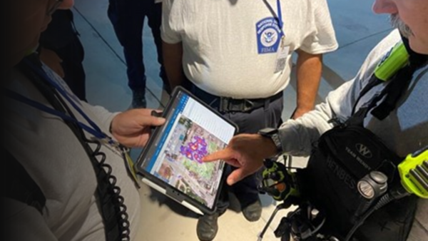
NAPSG Foundation supported FEMA in the development of the guide by creating and sharing symbols to address community needs. This work was done as part of NAPSG’s Symbol Library project. The library includes a consistent incident symbology framework, guideline, and symbol set for use at the incident level on maps and in GIS applications. It is made available to the public at no-cost.

The symbols developed by the NAPSG Symbology Working Group for the FEMA Guide to Alerts and Warnings will be available in the June 2022 Symbol Library update. Alerting authorities interested in how to leverage alert symbols can find additional guidance from the FEMA Integrated Public Alert & Warning System (IPAWS) Tips: Tip 36: The IPAWS Symbol Set.Access NAPSG’s Symbol Library
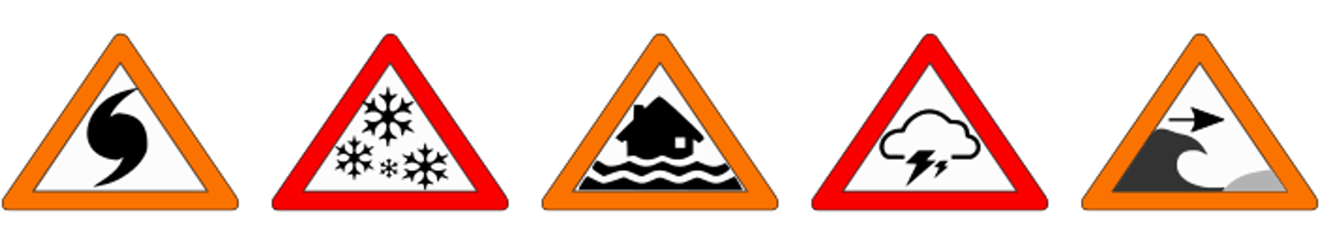
The Guide for Alerts and Warnings and other FEMA preparedness products are based on FEMA’s research about disaster preparedness, preparedness behavior change, and protective actions that individuals can take to prepare for, keep safe during, and recover from disasters. In addition to its printed publications like the Guide for Alerts and Warnings, FEMA regularly publishes the FEMA Data Digest, a one-stop-shop for public safety leaders, first responders, emergency managers, GIS practitioners, and preparedness practitioners to find data-informed calls to action, graphics, messaging, and guidance to share with the public. The Data Digest highlights FEMA’s research-validated protective actions, preparedness resources, and data-informed opportunities to motivate the whole community to prepare. This resource is designed so that preparedness practitioners can easily incorporate and adapt the messaging and information for their own local-level preparedness outreach.


If you’re interested in learning more about the Guide for Alerts and Warnings, FEMA’s Data Digest, or FEMA’s research, please send an email to FEMA-Prepare@fema.dhs.gov.

New Publication: NMATE 2021 After-Action Report

February 3, 2022

Now Available!

Access the AAR

Mutual aid is crucial for a unified response to and recovery from emergencies of all types and scales. Effective resource management practices in the preparedness phase and during incident operations enable efficient mutual aid.

To support the whole community in implementing the resource management preparedness process, the Federal Emergency Management Agency (FEMA) provides a suite of web-based resource management tools as part of the National Resource Hub. The National Resource Hub was at the core of the 2021 National Mutual Aid Technology Exercise (NMATE).

NMATE 2021 was conducted to demonstrate and exercise policy and technology interoperability among resource and incident management systems through the seamless exchange of priority information and application among different organizational structures. NMATE was conducted virtually over a six-week period, culminating in an in-person hotwash at FEMA Headquarters on December 1, 2021.

The NMATE 2021 After-Action Report is now available. The report provides a summary of exercise outcomes and findings, along with priority actions and requirements identified by participating stakeholders.


This effort was made possible through a partnership with the U.S. Department of Homeland Security’s Science and Technology Directorate (Agreement #70RSAT18CB0000041).

Updated Version Now Available! Guidance on Information Sharing Standards

November 23, 2021

The National Alliance for Public Safety GIS (NAPSG) Foundation is pleased to release the third version of the Implementation Guidance: Information Sharing Standards for Crisis Management Mutual Aid Technology. 

Previous versions of the guidance addressed two specific audiences (i.e., Public Safety Leaders and Technologists/Vendors) in a single document. The third version has broken the guidance into two separate documents:

  • Job Aid: Incident Management Technology – Aids in determining the appropriate standards and implementation options based on specific operational needs and requirements. This document is focused on the role of Public Safety Leaders.  
  • Technical Guide: Incident Management Technology – Provides technical guidance on information sharing standards and specific workflows for technically implementing the various information sharing standards available today. This document is focused on the role of Technologists and Vendors. 

In addition, the Job Aid has been adapted into an interactive StoryMap.

Download the Guidance! 


This effort was made possible through a partnership with the U.S. Department of Homeland Security’s Science and Technology Directorate (Agreement #70RSAT18CB0000041).

A Note From the Chairman: NAPSG’s New Mission Statement

November 17, 2021

Dear Friends & Colleagues,

My name is Chris Diller, and I am the Chairman of the Board of Directors of NAPSG Foundation. Whether you are hearing about NAPSG for the first time or you have benefited from our resources for years, it is my pleasure to share with you today our new mission statement.

“Why did NAPSG change its mission statement?”

You might be asking, “Why did NAPSG change its mission statement?”. Well, what we do has not changed. Our focus has always been about helping first responders, emergency managers, government and non-government entities alike to bring geospatial technology to life, giving them a capability set that improves decision-making.

In 2005, when NAPSG was first formed, our mission was aligned with the federal mission. However, countless disasters later the federal mission has changed a bit. It recognized “Whole Community” -that everyone needs a plan and should be part of the solution. At NAPSG, we made that adjustment over the years, but we never changed our mission statement to reflect that change. So, NAPSG went through a period of self-reflection and strategic planning recently in an effort to see if the mission statement needed to be adjusted. Think of it as resetting our compass to align with the change in magnetic north. We were always going in the right direction; we just needed to account for the federal change in mission.

The new Mission Statement focuses on three main points:

  • We at NAPSG have always been focused on bringing geospatial technology and capabilities to the public safety community, but we felt it important not to drive or dictate these technologies. You, the practitioner, have a stake and should have a voice in helping NAPSG develop these capabilities.
  • It is our role to help foster the adoption of these tools and capabilities for daily use. You have heard the phrase, “Train as you fight.” What good is GIS if you only use it once in a while or only during disasters?
  • Bridging gaps. Our role is to help connect public safety and emergency managers with mapping professionals. Connecting people across agencies and even disciplines. Connecting is protecting.

Lastly, NAPSG strives to do all this at no cost to you. Resources like Best Practices, education and training materials, and event materials are just a few of the items you can access for free on our website. You can also attend any one of our virtual events for free, including our annual InSPIRE conference — the Innovation Summit for Preparedness and Resilience. This has always been a core fundamental benefit to all. We do this through partnerships and grants, focusing on you the practitioner.

I encourage you to read the entirety of the mission statement on our website found at About Us and to learn more about NAPSG Foundation.

Thank you for your continued support and dedication to our joint mission!

Warm Regards,

Chris Diller
Chairman, NAPSG Foundation


New Publication: Key Findings and Action Plan for 2021 National Resource Management Summit

November 2, 2021

Now Available!

View the Key Findings and Action Plan for NRMS 2021.
Access the Report

As communities nationwide face incidents of increased complexity and scope, they require resources from across agency and jurisdictional lines to save lives, stabilize the incident, and protect property and the environment.

The National Resource Management Summit (NRMS)—held in April 2021 and co-hosted by the Federal Emergency Management Agency (FEMA), the U.S. Department of Homeland Security’s Science and Technology Directorate (DHS S&T), and NAPSG Foundation—provided an opportunity to collaborate with the community in defining mission-critical requirements for resource management preparedness technology and tools to maximize value and increase use among state, local, tribal, and territorial agencies, and other partners.

The Key Findings and Action Plan for NRMS 2021 is now available. The report identifies key functional areas and corresponding solutions through which resource management preparedness technology can be advanced.

Through ongoing collaboration and engagement, we can collectively address key challenges and mature resource management and mutual aid coordination across our nation. This report and the recommendations identified therein provide one step toward that solution.


This effort was made possible through a partnership with the U.S. Department of Homeland Security’s Science and Technology Directorate (Agreement #70RSAT18CB0000041).

News Release: Preparing First Responders with Critical Tools and Technologies

September 20, 2021

As part of National Preparedness Month, the Department of Homeland Security Science & Technology (DHS S&T) Directorate published the article “Preparing First Responders with Critical Tools and Technologies,” which illustrates how S&T prepares teams to be ready at a moment’s notice.

The two most recent events discussed in the article were the Champlain Towers South collapse and Hurricane Ida. These events brought to light some of the challenges faced when preparing for both no-notice and forecasted events. The National Alliance for Public Safety GIS (NAPSG) Foundation, funded by DHS S&T, has developed tools focused on improving flood preparedness and response. These tools, however, have easily been applied to other hazards, including Chaplain Towers, Hurricane Ida, and the ongoing wildfires. The tools can be scaled to meet the needs of local, state, and federal stakeholders on a single platform.

“…the Search and Rescue Field Data Collection and Situational Awareness Platform was deployed during the Champlain Towers South collapse and Hurricane Ida, where FEMA and the NAPSG Foundation were able to utilize GIS technology to help the responding US&R teams effectively plan and track search progression, provide a mechanism to follow up on critical issues, and inform executive leadership about incident status in near real-time.”

Read the full article

2021 Hurricane GIS & Situational Awareness Resources

August 30, 2021
Last Updated: 10:46AM EDT

Hurricane Forecasts and Advisories

NHC Website
Visit NOAA’s National Hurricane Center (NHC) for the most authoritative source for Hurricane Advisories.

Hurricane Situational Awareness

Situational Awareness Viewer
NAPSG Foundation has a lightweight and publicly accessible situational awareness viewer for the community to access basic information on incidents and forecasts.

FEMA’s Geospatial Resource Center

FEMA’s Hub Site
FEMA’s Geospatial Resource Center includes data, maps, dashboards, and applications from FEMA; state, local, tribal, and territorial (SLTT) and interagency partners; and the response community. The site includes a page of incident-specific content for Hurricane Ida including near real-time data feeds, model outputs, and imagery.

PhotoMappers Public Portal

Crowdsourced Photo Gallery
Use this app and map to get a picture of 2021 hurricane damage at the ground level.

How you can help? Sleuth the web for photos from social media (Facebook, Twitter, etc.) that indicate flood impact in areas affected by 2021 hurricanes and have a location identified (street address, neighborhood, town, etc.) and add them to the map.

Core Information Needs

All-Hazards Core Information Needs
Base and Live Data for Hurricanes
This Gallery displays datasets curated for the All-Hazards Core Information Needs Group, an ArcGIS Online Group with layers that address core information needs related to all-hazards. The purpose of this group is to serve as a starting point for geospatial decision support tools that rely on base data and live data. It is an outcome of the First Responder Core Information Guideline project.

Crisis Communication Catalog

Crisis Communication Catalog Contribution Page
Crisis Communication Catalog Hub Site
Knowing where to access information during a disaster is crucial. The Crisis Communication Catalog is an effort to build a nationwide geo-dataset of the best sources for public safety and incident status information in communities across the nation. View the map and data currently available and/or contribute to building out the nationwide Crisis Communication Catalog!

HURREVAC

Launch or Request Access
HURREVAC is the National Hurricane Program’s hurricane decision support tool and can be used to assist government emergency managers in planning, decision-making, and responding to tropical cyclone threats and evacuations. Access is restricted to authorized users with approved credentials.

View a Summary of All Advisories: http://gisweb.dotd.la.gov/DOTD-EIC/2021HurricaneSeason/2021Storm09 (Courtesy of Louisiana Department of Transportation & Development)

NAPSG Foundation set to develop expanded incident symbology for ARES

June 14, 2021

NAPSG Foundation is pleased to announce that it has entered into a Cooperative Research & Development Agreement (CRADA) with the US Department of Homeland Security’s Science and Technology Directorate (DHS S&T). The goal of the CRADA is to develop an expanded set of incident symbols using the NAPSG Foundation Symbology Methodology, for use within the DHS Augmented Reality Sandtable (AReS), to be available to all public safety agencies at no cost. This CRADA is an expansion of an existing relationship between DHS S&T and NAPSG Foundation on the development of the NAPSG Foundation Symbology Methodology, which currently is available in the NAPSG Symbol Library.

NAPSG Foundation is honored to work with DHS S&T for this collaborative effort, and we know that the deliverables from this partnership will provide even greater and more effective tools for our public safety community.

Acknowledgment. “This publication is based upon work conducted under the U.S. Department of Homeland Security Cooperative Research and Development Agreement No. 21-TCD-002.” 

Disclaimer. “The views and/or conclusions contained in this document are those of the author(s) and should not be interpreted as necessarily representing the official policies, either expressed or implied, of the U.S. Department of Homeland Security (DHS), and do not constitute a DHS endorsement of the equipment tested or evaluated.” 

New Light Technologies, Dewberry, and NAPSG Foundation win FEMA contract

On November 2, 2020, New Light Technologies Inc. (NLT) announced they were awarded a new contract by the U.S. Federal Emergency Management Agency (FEMA). NLT has partnered with Dewberry and the NAPSG Foundation—two of the most well-known names in emergency management—to provide modeling, analytics, systems development, and training services for the Response Geospatial Office (RGO).

“Partnering with Dewberry and NAPSG will extend our ability to seamlessly synthesize environmental and critical infrastructure data, generate highly accurate analytics for large-scale disasters, and quickly deliver this information to the public and decision-makers across all echelons of government,” says NLT’s Program Manager Rob Pitts.

Read the full article


DHS S&T Webinar Series: Securing our Future Now

September 17, 2020

The DHS Science and Technology (S&T) Directorate is convening a diverse group of public-private partners to present a series of virtual discussions aimed at “securing our future now.”

We are pleased to invite you to the kick-off event, “Clearing the Path: Responding to Disasters During a Crisis,” which will take place Thursday, September 24th, from 1:00 pm to 2:30 pm Eastern.

Space is limited – be sure to register early! For more details and registration, please click here. Add to Calendar

Objectives
  • Understand how new public-private partnerships are accelerating new solutions and
    business models to prepare for day-to-day emergencies and a national crisis.
  • Educate community leaders on how new science and technology applications are
    enhancing resilience and protecting life-line systems and networks.
Questions and Call to Action
  • With the increased frequency of new threats, what new tools and policies are available to
    incentivize collaboration among government, industry, and foundations?
  • Communities are investing in automated and digital technologies; why is this important,
    and how are predictive data sets changing the way we think about risk and preparedness?
Speakers
  • David Maurstad, Deputy Associate Administrator, FEMA
  • Duane Caneva, Chief Medical Officer, DHS Countering WMD Office
  • Ted Smith, Ph.D., Wastewater Based Epidemiology, Professor of Environmental Medicine, University of Louisville

This event will be moderated by Dr. David Alexander, Director of Resilience Research and Partnerships, at the US Department of Homeland Security’s Science and Technology Directorate.

Register now for this no-cost event! https://www.eventbrite.com/e/securing-our-future-nownational-preparedness-monthregistration-119305268269