Monthly Archives: August 2017

Open Data for Hurricane Harvey

Hurricane Harvey Best Available Data

August 29, 2017 – At the request of FEMA, the Department of Homeland Security (DHS) Geospatial Management Office and the Department of Interior (DOI) stood-up a dedicated Open Data Site (HIFLD for Harvey) to aggregate the most relevant and best available data in a single place – to support Hurricane Harvey response and recovery across all levels of government and whole community partners. HIFLD for Harvey is publicly available at the link below:

HIFLD for Harvey is a part of the Federal Geospatial Platform infrastructure. NAPSG is honored to be a part of the HIFLD team with DHS, DOI, and ArdentMC in this critical effort.

Data Available Now

Over 60 data sets are accessible now in HIFLD for Harvey providing the best available data for Harvey-specific information requirements. More data is being added around the clock. This site is being curated to ensure it’s the most relevant and best available data for Harvey operations.

USNG Map Books for Affected Counties

HIFLD for Harvey contains 1:25K USNG Map Books for the affected counties. Map books for each county are being added to the site as produced, with 15 county map books available now. This is a critical resource for first responders and others supporting response and recovery operations. USNG Map Books are being produced in partnership with Delta State University.

How You Can Contribute to HIFLD for Harvey

  • Spread the Word! – Use #HIFLD4Harvey in social media posts. Share the website out with your friends and colleagues in anticipating GIS needs, mutual aid requests, and any related response/recovery efforts.
  • Got Data for Harvey? – If you have data that is directly relevant to Harvey that you consider best available, send an email with the link to the data to HIFLD@hq.dhs.gov.
  • Unmet Mission Critical Data Needs? – If you have identified a mission critical information requirement that is not currently supported by data available in HIFLD for Harvey, please let us know what the need is by sending an email to HIFLD@hq.dhs.gov.

Other relevant GIS resources for Harvey are available here: https://www.napsgfoundation.org/hurricane-harvey-resources/
Crowdsourcing App for Hurricane Harvey Available Now

August 26, 2017 – The National Alliance for Public Safety GIS (NAPSG) Foundation launched a crowdsourcing application to help collect images taken from the field during and after Hurricane Harvey.

  • If you are on the ground in the impact area, you can contribute your images to the app very easily using your mobile device.
  • You can also use the app if you are trying to assess the type and extent of damage in the impacted areas to:
    • Prepare for mutual aid requests
    • Support situational assessment
    • Aid operational readiness for deployment to the field
    • Other response and recovery functions

Check it out, share it around, and if you are there – contribute!

DHS S&T Highlights NAPSG’s National Mutual Aid Technology Exercise

Originally published by the U.S. Department of Homeland Security’s Science and Technology Directorate on August 22, 2017 @ https://www.dhs.gov/science-and-technology/news/2017/08/22/snapshot-national-mutual-aid-technology-exercise-brings

Snapshot: National Mutual Aid Technology Exercise Brings Together a Diverse Group

One of S&T’s visionary goals is to enable communities to be disaster-proof. S&T cannot eliminate disasters, but it can arm decision makers with tools and plans that will ultimately shield communities from negative consequences. A critical step towards building disaster-proof communities is being able to ask and receive help from a neighbor. Though most disasters begin and end locally, large-scale and catastrophic disasters require coordinated mutual aid from a broad range of partners across geographic boundaries.

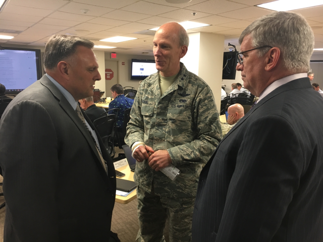
Under Secretary (Acting) of Science and Technology Directorate meets with stakeholders.

Based on this need, Department of Homeland Security’s (DHS) Science and Technology Directorate ( S&T) collaborated with the National Alliance For Public Safety GIS (NAPSG) Foundation to hold the first ever National Mutual Aid Technology Exercise (NMATE) June 28-29, at the Federal Emergency Management Agency (FEMA) Headquarters. The exercise, sponsored by S&T’s  First Responders Group (FRG), brought together technologists, operators, and decision makers from all over the country to determine to what extent existing mutual aid technology systems are able to share and incorporate each other’s resource and situational awareness information.

Based on a simulated wildfire scenario in a locality with limited resources, the exercise was conducted in one large room, simulating an Emergency Operations Center (EOC) environment. Federal, state, and local participating organizations included the American Red Cross, the New Hampshire National Guard, and International Association of Fire Chiefs. Each organization brought along a mutual aid platform they employ in their jurisdiction.

The overall goals of NMATE were to establish and coordinate dialogue, conduct technical testing among the owners of technology-enabled mutual aid systems, and ultimately build a shared understanding and information exchange between mutual aid technology systems. This shared understanding will help these systems work together more efficiently and effectively in the future, and serves as the foundation for developing technical guidance for mutual aid information sharing in real-time.

“It is incredibly difficult to get all of these people into a room at the same time,” said DHS S&T FRG Program Manager Ron Langhelm. “The benefit is that participants could walk over and talk to one another, something that is rarely possible in a real-world scenario.”

The simulation, a 5,000-acre wildfire that started north of the Wolf River Nature Preserve between Grand Junction and Williston, Tennessee, asked participants to role-play the process to provide resources for the area with their mutual aid technology. These resources included wildfire resources for wildfire containment and control, air resources, fire resources for structural protection, and overhead for incident management teams. As NMATE continued over the two days, NAPSG introduced data, or injects, to test the interoperability of the different mutual aid technology platforms.

“From the S&T perspective, we wanted to find out the challenges these systems have regarding working together,” said Langhelm. “Figuring out what the issues were will help us in a real scenario get help where it’s needed.”

Several issues were encountered during the exercise. Eliminating redundant resources, use of common fields of data among all platforms, how to provide incentive for a community to participate in mutual aid were all discussed in a no-fault setting. An after action report will be produced to give communities best practices.

“Having FEMA here as a partner, a building like this to work in, right with people who are doing the mission is great benefit to S&T,” said FRG Director Dan Cotter in an opening keynote address at NMATE. “The real gaps, the real understanding what we need to do, the requirements come from you (the participants) in meetings like this.”

Press Release – 2017 Awards for Excellence in Public Safety GIS Recipients Recognized at the National Geospatial Preparedness Summit

August 22, 2017

Media Contact: Peter O’Rourke, 202-895-1711, porourke@publicsafetygis.org

PDF Press Release

Washington D.C – The National Alliance for Public Safety GIS (NAPSG) Foundation Board of Directors is pleased to announce Major General William N. Reddel of the New Hampshire National Guard, Richard Butgereit of Florida’s Division of Emergency Management, and Chad Council of the Federal Emergency Management Agency, as recipients of the 2017 Award for Excellence in Public Safety GIS. Awards were presented at a special reception during NAPSG Foundation’s annual National Geospatial Preparedness Summit on August 8, 2017, in Tuscaloosa Alabama.

“The NAPSG Foundation Board of Directors is honored to recognize the exceptional leadership and advancements that this year’s awards recipients represent,” said Chief Rand Napoli, Board Chairman of the NAPSG Foundation. “This year’s recipients represent a unique combination of visionary leadership and measurable progress in applying data and analytics for improved first responder operations.” NAPSG Foundation receives nominations for award recipients each year, and the Board votes on awards in all or some of three categories – local/regional, state, and national/federal.

Concurrently, the 3rd annual National Geospatial Preparedness Summit, held August 7-9 at the University of Alabama in Tuscaloosa, brought together more than 215 public safety and homeland security leaders, first responders, and GIS professional representing 39 states and 120 agencies. The summit was coordinated in coordination with the US Department of Homeland Security, International Association of Fire Chiefs, International Association of Emergency Managers, National Association for Search and Rescue, the National States Geographic Information Council, the Naval Post-Graduate School’s Center for Homeland Defense and Security, and other partner organizations.

The summit is the only national training and preparedness exercise forum dedicated to advancing the use of geospatial information system technology and data by our nation’s first responders. This year’s programming featured hands-on technical GIS training on the latest technology and analytics, a tabletop exercise focused around a complex coordinated attach scenario, keynote speakers from leading local and national agencies, and numerous workshops on issues ranging from damage assessment processes to emerging technologies. The summit culminated with a one-day functional preparedness exercise based on a real-world flood scenario.

The National Geospatial Preparedness Summit is always hosted at no cost for public sector participants from federal, tribal, state, and local governments.

About NAPSG Foundation – www.napsgfoundation.org

The National Alliance for Public Safety GIS (NAPSG) Foundation is a 501(C)(3) not-for-profit organization dedicated to equipping first responders and leaders with the knowledge and skills in applying technology and data to change the outcome for survivors. The vision is achieved through the development and delivery of cutting-edge education, training, exercises, technical assistance, tools, and national policy and guidance. For more information on NAPSG Foundation contact Peter O’Rourke, Executive Director, at 202-895-1711 or porourke@publicsafetygis.org.