January 22, 2019
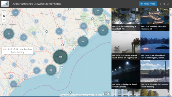
In the 2019 Winter Edition, ArcNews posted an article describing how organizations are “employing Web GIS before, during, and after disaster” using Hurricane Florence as a case study. One example provided in the article Weathering Hurricane Florence is the 2018 Hurricanes Crowdsource Story Map, which was hosted by NAPSG Foundation and supported by volunteers from the GISCorps, NAPSG SAR Working Group, NZGIS4EM, and CEDR Digital. Crowdsourced photos were added to a live map to provide early situational awareness before Hurricane Florence even made landfall. Paul Doherty (NAPSG Foundation Programs Manager) and Peter O’Rourke (NAPSG Foundation Executive Director) also provide their perspectives on the advancing use of geospatial tools during disaster.
Additionally, the article highlights Humanity Road for their assistance to the US Coast Guard, and the GIS Teams from City of New Bern, NC, and South Carolina Emergency Management. These examples from Hurricane Florence provide insight beyond just geospatial technology used in response; they illustrate the deeper need for a dedicated community of GIS Specialists, emergency managers, and first responders to be prepared for the complexity of tomorrow’s disasters.
See entire article – Weathering Hurricane Florence