August 30, 2021
Last Updated: 10:46AM EDT
Hurricane Forecasts and Advisories
NHC Website
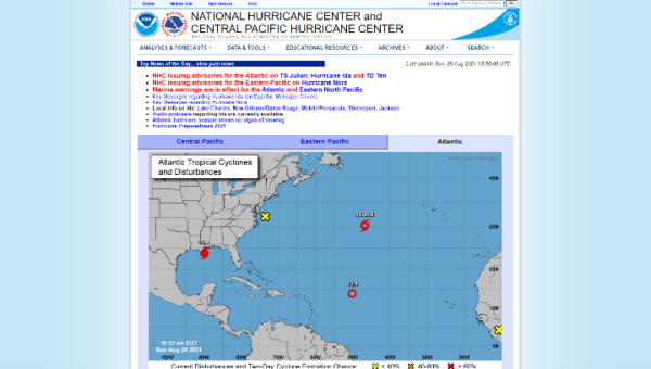 Visit NOAA’s National Hurricane Center (NHC) for the most authoritative source for Hurricane Advisories.
Hurricane Situational Awareness
Situational Awareness Viewer
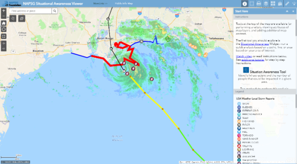 NAPSG Foundation has a lightweight and publicly accessible situational awareness viewer for the community to access basic information on incidents and forecasts.
FEMA’s Geospatial Resource Center
FEMA’s Hub Site
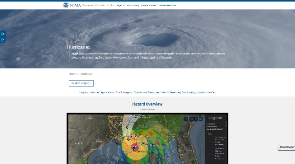 FEMA’s Geospatial Resource Center includes data, maps, dashboards, and applications from FEMA; state, local, tribal, and territorial (SLTT) and interagency partners; and the response community. The site includes a page of incident-specific content for Hurricane Ida including near real-time data feeds, model outputs, and imagery.
PhotoMappers Public Portal
Crowdsourced Photo Gallery
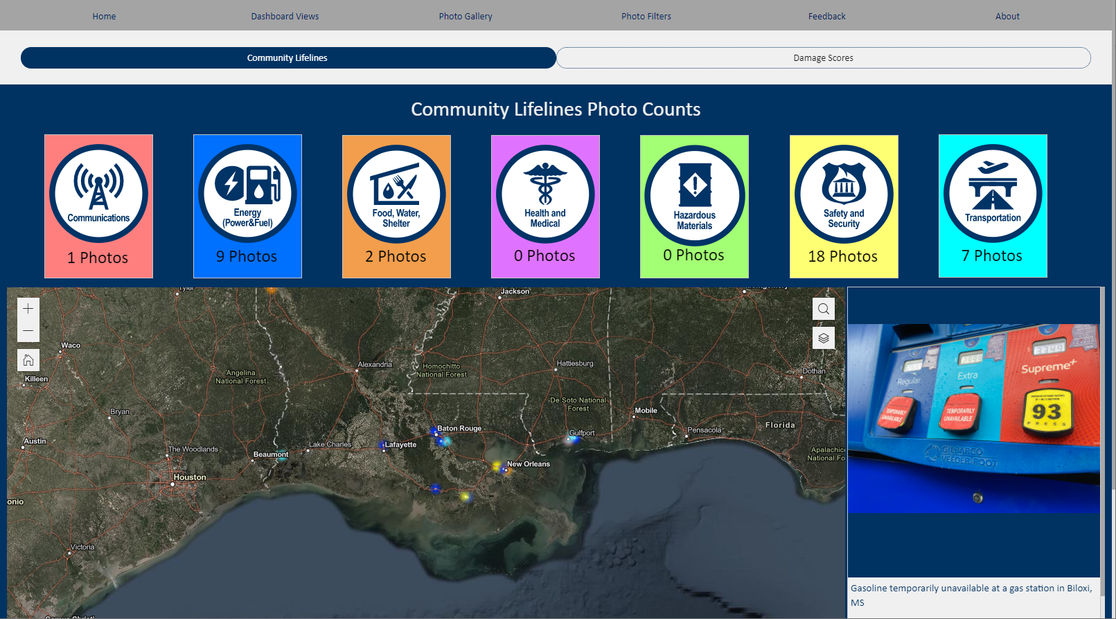 Use this app and map to get a picture of 2021 hurricane damage at the ground level.
How you can help? Sleuth the web for photos from social media (Facebook, Twitter, etc.) that indicate flood impact in areas affected by 2021 hurricanes and have a location identified (street address, neighborhood, town, etc.) and add them to the map.
Core Information Needs
All-Hazards Core Information Needs
Base and Live Data for Hurricanes
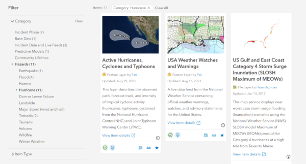 This Gallery displays datasets curated for the All-Hazards Core Information Needs Group, an ArcGIS Online Group with layers that address core information needs related to all-hazards. The purpose of this group is to serve as a starting point for geospatial decision support tools that rely on base data and live data. It is an outcome of the First Responder Core Information Guideline project.
Crisis Communication Catalog
Crisis Communication Catalog Contribution Page
Crisis Communication Catalog Hub Site
![]() Knowing where to access information during a disaster is crucial. The Crisis Communication Catalog is an effort to build a nationwide geo-dataset of the best sources for public safety and incident status information in communities across the nation. View the map and data currently available and/or contribute to building out the nationwide Crisis Communication Catalog!
Knowing where to access information during a disaster is crucial. The Crisis Communication Catalog is an effort to build a nationwide geo-dataset of the best sources for public safety and incident status information in communities across the nation. View the map and data currently available and/or contribute to building out the nationwide Crisis Communication Catalog!
HURREVAC
Launch or Request Access
 HURREVAC is the National Hurricane Program’s hurricane decision support tool and can be used to assist government emergency managers in planning, decision-making, and responding to tropical cyclone threats and evacuations. Access is restricted to authorized users with approved credentials.
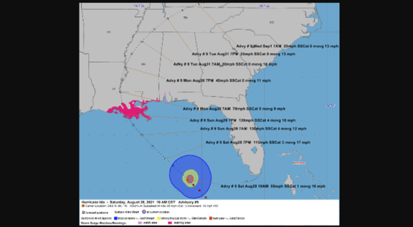
View a Summary of All Advisories: http://gisweb.dotd.la.gov/DOTD-EIC/2021HurricaneSeason/2021Storm09 (Courtesy of Louisiana Department of Transportation & Development)


