NAPSG Foundation relies on the strength of our national practitioner network and our Regional Leadership Teams to advance our common mission in every state, region, and locality across the United States. To support the national programs and address policy issues, our core management and staff team are charged with coordinating our regional leadership teams and the national practitioner network.
Peter O’Rourke – Executive Director
 I started my career in Washington, DC, with the U.S. Department of Energy in the nuclear weapons cleanup program. This led me to understand the practical impacts of technical solutions helping to solve operational challenges.
I was first exposed to GIS through work I was doing on pipelines. And in 2005, I helped to create the NAPSG Foundation and was asked to be its founding Executive Director. Starting with a handful of public safety organizations in its network, NAPSG has grown to include thousands of agencies across all disciplines in all 50 states and around the globe. I am very proud of what we have accomplished since 2005, and I measure my success as Executive Director on the participation of our ever-growing network of members. There is much more work to be done at a time when geospatial technology is rapidly evolving and becoming more mainstream. It is an honor to lead the charge in overcoming these challenges, executing NAPSG’s mission, and seeing our vision to fruition.
Tommy Hicks – Deputy Executive Director

As a career firefighter, I had no idea what the letters GIS stood for until I had the opportunity to be involved in a statewide project documenting and installing drafting hydrants in the early 1990s. I asked if there was a way to capture electronically the location and size of each water source that led to a backpack and decoding satellite data for the forestry service.
With over 30 years of experience in the fire service, I have always identified the importance of geospatial data and how important this information is in making good decisions. My passion started as a volunteer with the Hanover County Fire Department in Virginia. I have diversified my background and experiences highlighted by positions in fire protection consulting, the insurance industry, and the municipal fire service, including Emergency Manager and Fire Chief. I still value the educational opportunities I received from Oklahoma State University and have been blessed to serve as a Guest Speaker at state, national, and international venues. I enjoy the opportunity to continue mentoring future professionals as an Instructor.
Tari Martin – Director
 I first became excited by Geographic Information Systems in its applications for environmental issues. I began my career working on environmental security assessments and was amazed by how impactful geospatial applications could be in assessing hazards and their associated risks. Since then, I have worked at both the municipal and county levels supporting Emergency Management, Law Enforcement, and Fire and Emergency Medical Services. Public safety is such an exciting and fast-paced environment. I have loved working in a field where I get to help first responders and those that they protect. Finding and developing practical and innovative solutions to help them prepare for, respond to, mitigate against and recover from emergencies has been a rewarding endeavor.
I have learned a lot from my time staffing Emergency Operation Centers, working with a Regional Incident Management Team, and a County’s Mobile Command and Communications Team. I have worked on all kinds of emergencies, from natural disasters to pandemics to security threats, and large-scale planned events. As a geospatial professional, I have worked on regional and state groups bringing folks together to address those challenges we all face. I was the Chair of the Baltimore Regional GIS Subcommittee under the Baltimore UASI and the co-author of the URISA Certified workshop, Emergency Management for GIS Professionals. Currently, I sit on the Maryland State Geographic Information Committee Public Safety/NG911 Subcommittee and the URISA Community Resilience Committee. I am thrilled to be a part of an organization that shares my passion for supporting public safety and bringing people together. It has and continues to be an exciting and rewarding field.
Kevin Kay – Director
 My interests have always involved being in and supporting Public Safety. I believe that geospatial technologies are the key to improving responder outcomes and critical decision-making.
I started my career in the United States Army as an Infantryman (82nd Airborne) with two deployments in support of Operation Iraqi Freedom. My exposure to GIS technologies included early versions of unmanned aerial systems and battlefield tracking software. I understood the importance of having spatial information delivered in real-time and saw firsthand how it can improve decision-making. After I separated from the Army, I completed my M.A in Public Administration. For the past seven years, I worked for a local Colorado Sheriff’s Department as an Emergency Management Specialist, Homeland Security Analyst, and Deputy Emergency Manager. I have incorporated GIS into hazard mitigation planning, critical infrastructure analysis, and EOC operations.
NAPSG Foundation has done tremendous work in Colorado as part of a pilot flood project, and I am excited to be part of a team that understands the importance of bridging the gap between responders and GIS professionals.
Jared Doke – Program Manager

My background is diverse, yet it revolves around a common theme—public safety. After receiving an associate degree in Fire Science from a community college close to home, I attended Washburn University and dual majored in Criminal Justice and Anthropology. As an undergrad, I volunteered at a fire department where I would later become a full-time firefighter, gaining invaluable experiences as an active member of the dive and technical rescue teams. During this time, I completed an M.A. in Geography with an emphasis in GIS and focused my thesis on lost person behavior in Yosemite National Park. I went on to intern at Esri and gained experience applying GIS to real-world situations through wildfire response and working with a Nevada Type 3 Incident Management Team. I was also given the opportunity to teach GPS courses throughout the state of Kansas for Midwest Search and Rescue and to serve as a member of the Kansas GIS Response Team. Most recently, I spent four years as a contractor for the National Park Service conducting wildfire risk assessments on park facilities nationwide to support the Wildfire Risk Assessment project. In 2018, I became a Tech Info Specialist for Missouri Task Force One (MO-TF1).
NAPSG Foundation provides me with a great environment in which to collaborate with others and draw on my strengths, experiences, and training to tackle real-world problems. I am excited about the opportunity to further learn and grow in this industry while contributing positive change in public safety.
Bree Yates – Program Specialist
 The spark of passion for community service was lit in high school when I began volunteering for a non-profit that showed me not only how a community could do so much when it supported each other, but also how public safety was a true family. It was working with this nonprofit that I learned the true value of teamwork, problem-solving, and management. After graduating from Old Dominion University, my hunt for this type of field began.
It wasn’t until 2015 that I was reintroduced to a career in public safety. I was given the opportunity to work as the Volunteer Manager with the World Police and Fire Games, which cemented my belief that I had found the right field. I have worked with many Public Safety Agencies: FEMA, the International Association of Fire Chiefs, and the Department of Corrections, to name a few.
I have a strong desire to help others while making a difference, which is why I am grateful to work with a company that has the same views.
Adam Fackler – GIS Technician
 My career in public safety started back in high school when I was a Law Enforcement Explorer with the Lake Zurich Police Department. After several years of being an Explorer, I knew I wanted to be involved with some form of public safety. From there, I attended Western Illinois University, majoring in Law Enforcement with dual minors in Emergency Management and GIS.
I began to get more involved with both Emergency Management and GIS as I became a student worker at the Western Illinois University GIS Center. While at the GIS Center, I gained real-world GIS experience while still an undergrad, working on a variety of projects including maintaining the Macomb Public Works database, creating a map book of the Spoon River in Fulton County, IL, and working on NG911 for several counties around West-Central Illinois. I was also able to assist in several incidents at the local and state level, including the 2018 Taylorville tornado, the 2019 Polar Vortex, the 2019 Illinois Flood, and several search and rescue missions.
I began to work with NAPSG after I finished my undergrad in 2019. My favorite part about working at NAPSG is being able to work alongside knowledgeable personnel who are dedicated to NAPSG’s mission of equipping emergency managers with GIS technology to enhance preparedness in their community. I am excited to be a part of this organization, and I look forward to all the opportunities and experiences to come!
Emma Montague – GIS Technician
 I developed a passion for GIS as an Environmental Science student at Sonoma State University. After graduating, I was drawn more towards the public safety direction. My experience working as Mountain Safety at Breckenridge Ski Resort gave me a taste for emergency response.
I later moved to Montana to lead a youth crew for the Montana Conservation Corps. Through MCC, I became familiar with the US Forest Service and began fighting wildfire on Bitterroot Helitack, a Type 3 Initial Attack Helicopter crew. I came to appreciate the unified structure of responding to large emergencies. After four years, I was craving the opportunity to incorporate my passion for GIS, which encouraged me to attend the University of Montana for a GIS Certificate.
While I interned for Missoula County Clerk and Recorder’s Map Missoula, I mapped the historical record of deeds, which later became a publicly accessible web-portal for current and historic property information. I also worked as a Cartographer at the University of Montana, illustrating the change in land conservation over the years for Saving the Big Sky. At NAPSG, I aspire to combine my experience in wildland fire with GIS and contribute to all the organizations working to improve public safety.
Angela Pervél – Operations Specialist

Some of my favorite memories revolve around taking humanitarian trips with my family to developing countries. Helping others has been my aspiration since I was a teenager, and it is the reason I pursued a nursing degree. Growing up in Puerto Rico, we experienced many natural disasters. Through these often catastrophic events, I grew to appreciate and understand how important a well-trained and prepared emergency response capability can be to a community.
In 2007, I began working for the American Red Cross in Missouri as a phlebotomist, traveling the region collecting blood donations, and I taught CPR skills at the Southern Missouri Chapter. Working for the ARC and teaching helped further my interest in public health and safety. At NAPSG, my responsibilities include managing virtual training and event registrations, updating website content, maintaining our contact database, coordinating event logistics, and providing support to the project managers.
ADVISORS
Amy Chetelat – Certified Association Executive – Stringfellow Management Group, Inc.
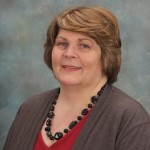 Early on in my career, I found that I love working with numbers and using them to tell the financial story for the organizations I’ve worked with. I began working with nonprofit organizations in 1995 when I decided to move away from corporate accounting. Since that time I have worked with many foundations, charitable organizations, trade, and professional associations. I became enthralled with GIS and public safety when I had the opportunity to work with NAPSG and another organization that deals with GIS. I find that by using data mapping and applying it to financials, there is something new and interesting to learn every day.
Kate Davis – Human Resources Manager – Stringfellow Management Group, Inc.
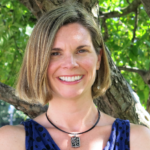
As Human Resources Manager, I assist with recruiting, new hire onboarding, benefits enrollment, payroll, and general HR-related functions. I have a B.A. in Mathematics from Bard College and earned my Certified Employee Benefit Specialist (CEBS) designation in 2000. I have over eight years of experience in HR and eight years of experience working in a consulting environment for retirement plans, as well as three years of accounting experience. One of the most rewarding parts of my job is working directly with employees and helping with critical tasks that are essential to operations.
Judy Crossland – Staff Accountant – Stringfellow Management Group, Inc.
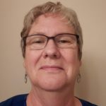 As Staff Accountant, I assist with daily accounting operations and financial activities. My particular area of expertise is grants and contracts, which is a large part of the work I do for NAPSG. I have spent the majority of my 33-year accounting career with human services nonprofit organizations dealing with issues ranging from child care to disabilities and substance abuse. Working with NAPSG has taken me in a different but fascinating direction.
Mary Skudzinskas – Accounting Manager – Stringfellow Management Group, Inc.

As Accounting Manager, I assist with the daily accounting operations and financial activities of the NAPSG Foundation. I have a Bachelor’s degree in Business Administration from Loyola University, Maryland. I have over 15 years of experience in the General Accounting field. I am passionate about accounting and integrating technology into our day-to-day operations.
Francis A. McElhill, Esquire – Legal Counsel – Archer & Greiner, P.C.
TECHNICAL ADVISORS
Pete Hanna
 I am a Firefighter/Paramedic with the Baltimore City Fire Department (BCFD). I joined the BCFD in 1998 and have been assigned to Medic 7, Truck 1 and Engine 6, which are some of the busiest apparatus in the region/nation. After being injured on a fire ground in 2007, I was detailed to the BCFD Information Technology Division to aid in a project with the Department of Public Works (DPW). The project’s goal was to map all the hydrants of the city. I became passionate about GIS following this, and I am now assigned to our IT department where I manage all the GIS needs for the department.
I have become a member of many working groups in my area and region, but the work I do for NAPSG excites me because we are working to improve the use of GIS in the public safety arena. I feel that GIS is an incredible tool that is underutilized and can help agencies become more efficient, make better decisions, and create safer working conditions for first responders, which will allow them to save lives and property.
Colleen Livingstone
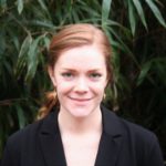 I have been passionate about geospatial technologies since I was an undergraduate, but I first became interested in public safety issues while working on my Masters of Science in GIS and did my capstone project on the use of GIS to improve health and safety for international NGO workers. After graduating, I interned as a GIS specialist in the U.S. National Park Service’s Law Enforcement, Security, and Emergency Services division. In that position, I was exposed to a wide range of public safety issues, and I saw the importance of high-quality spatial data and analysis for situational awareness and effective planning. I worked primarily on leveraging GIS in support of search and rescue (SAR) with a focus on setting up systems to collect spatially-explicit SAR data for better planning and prevention.
During my work with the Park Service, I had the opportunity to collaborate with partners in other government and non-governmental organizations, including NAPSG, around the use of geospatial technologies to support lifesaving efforts following hurricanes. In the course of this collaborative work, I saw the positive impact of the commitment and technical expertise that NAPSG staff contributed to the public safety effort. I am glad to have become a part of the NAPSG team, and I hope to continue supporting the public safety mission at that high standard.
Chris Rogers
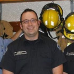 I’m a fire lieutenant with over 31 years of experience and an unusual fascination with maps. I started my fire service experience as a resident firefighter while going to college for cartography. I realized my professional passion was being a firefighter. However, I never lost my excitement for cartography. I became a career firefighter in the Seattle area nearly 25 years ago. When my department hired me, they had in the back of their mind that “this is the guy who is going to fix our maps”. My department was one of the first users of GIS in the region. This ignited my passion for the uses of GIS in the fire service. I truly believe that GIS is a tool that will make my profession safer.
Shelby Roberson

I’m a GIS Professional and Geographer who has had a fascination with maps and all-things geography my whole life. Growing up, I never knew that a “Geographer” was someone I could be until I stumbled upon the Geography Department as an undergraduate at the University of Mary Washington in 2005. In 2010, I received my master’s in Geography from the University of South Carolina and I have been working in the GIS field ever since!
I’m currently the GIS Manager for the Montgomery County, MD Police Department, where I spend my days managing our ArcGIS Enterprise deployment, ensuring our 911/CAD data is up to date, supporting our team of Crime Analysts, and much, much more. I’m passionate about Public Safety and have worked for many years supporting Police, Fire, and Emergency Management at the local and federal levels. I truly love using geospatial technologies for Public Safety because I know that the work that I do is helping our public while making the jobs of first responders safer and easier. I really enjoy the technical side of GIS and I’m always willing to be the first to try out the latest-and-greatest GIS technology. I make it my priority to find ways to apply these new GIS technologies to Public Safety GIS.
Orlando Viera Serrano
 I am a Fire Engineer with the Santa Maria City Fire Department and a USAR Technician, Technical Search Specialist, and Technical Information Specialist with CA Regional Task Force 12. My day-to-day assignment is all-hazards response on Engine 2/USAR Heavy Rescue 2. My interest in GIS and GEOINT in the search and rescue space began in 2018 with the development of a SARCOP-like system for CA RTF 12. Successful use of our in-house system alongside an early version of SARCOP at the North Complex Fire in 2020 catalyzed Cal OES’ final jump into the SARCOP we know today.
I continue to be involved in a variety of fire department GIS projects like digital pre-incident planning, department-wide metrics dashboards, hydrant data capturing and processing, and others. And as a member of the Technical Search Specialist cadre for CA State Training Institute/Cal OES, I get to share and sharpen skillsets with TSS/TIS students. I have seen the tremendous progress that even a small agency can make by harnessing the power of GIS/GEOINT and am excited to share those possibilities with others through my work at NAPSG.


