Resources
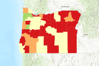
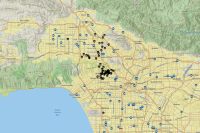 Catching the Hollywood Arsonist - Using ArcGIS Online
This map is used by students in Introduction to Human Geography, Forensic Geography, and perhaps other courses with a spatial analysis component where measures of central tendency are learned. Consult Introduction to Human Geography: A Disciplinary Approach for additional materials, including assignment instructions, videos, and supplemental instructional materials.
Type: Web Map
Last Modified: September 27, 2023
 Solving Crimes with Geology
Forensic geology and geomorphology play vital roles in crime-solving. Forensic geologists collect geological evidence at crime scenes, assisting in locating buried objects and providing valuable information for criminal investigations. Ground-Penetrating Radar (GPR) is a key tool in forensic geology, detecting hidden items and identifying graves. Upholding ethical standards is crucial in these disciplines, ensuring responsible sampling practices and adherence to sustainability principles. Overall, forensic geology and geomorphology contribute to solving crimes by utilizing geoscientific techniques to collect evidence and support law enforcement agencies.
Type: StoryMap
Last Modified: June 27, 2023
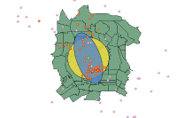 Catching the Hollywood Arsonist: Web Map
The layers in this ZIP file contain the multiple .shp files for the Hollywood Arsonist assignment for Introduction to Human Geography, Forensic Geography and other spatial analysis courses.
Type: Feature Service
Last Modified: September 21, 2023
 Forensic Cartography
Forensic science involves collecting, processing, and documenting evidence that is often invisible to the naked eye. Cartographic forensics seeks to detect the seemingly undetectable through the use of maps, images, and ancillary data. This workshop demonstrates how ArcGIS can reveal the location of features that are hidden or no longer exist and reconstruct landscapes and scenes from murky descriptions. GIS data, imagery, terrain surfaces, historical maps, and supplementary data, all of which contribute to the investigative process. Join us to find out how to see “beneath the surface” of geographic data to unearth previous unknowns.
Type: PDF
Last Modified: July 8, 2023
 Forensic Analysis
Forensics and Attribution Core Capability Forensic Analysis Results
Type: Web Map
Last Modified: May 21, 2021
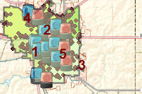
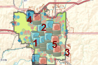
 Trueblood Implementation Regions
For geospatial analysis and reporting that supports DSHS and HCA Trueblood implementation activities
Type: Feature Service
Last Modified: August 31, 2022
 Biometrics Analysis
Forensics and Attribution Core Capability Biometrics Analysis Results
Type: Web Map
Last Modified: May 21, 2021
 CBRNE Material Analysis
Forensics and Attribution Core Capability CBRNE Material Analysis Results
Type: Web Map
Last Modified: May 21, 2021
 Police Crime Prevention Offices in Hong Kong
This layer shows the location of Police Crime Prevention Offices in Hong Kong.
Type: Feature Service
Last Modified: October 21, 2022
 Crime Prevention District
ArcGIS Server map service displaying crime prevention districts in EBRP.
Type: Feature Service
Last Modified: August 24, 2023
 Police Crime Prevention Offices in Hong Kong
This web map shows the location of Police Crime Prevention Offices in Hong Kong.
Type: Web Map
Last Modified: October 21, 2022
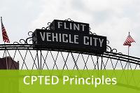 Crime Prevention Through Environmental Design in Flint, MI
Explore Crime Prevention Through Environmental Design (CPTED) as an approach to prevent violence and enhance safety in Flint, MI. The map defines CPTED principles and provides examples of how they were applied to strengthen Flint communities.
Type: Web Mapping Application
Last Modified: June 24, 2021
 Prescription drug drop-off and disposal locations in Arizona
This dataset contains the name, phone number, and location of all participating prescription drug drop off locations. Data location was provided by Drug Enforcement Administration (DEA) and AZ Crime Prevention. The phone numbers were provided by ADHS GIS in June 2022.
Type: Feature Service
Last Modified: June 2, 2023
 Counterterrorism Transportation Policy Changes Since 9/11
In the United States of America
Type: StoryMap
Last Modified: December 7, 2023
 Crime Prevention and Support
Locations of offices providing crime prevention and support in Los Angeles County
Type: Feature Service
Last Modified: February 4, 2016
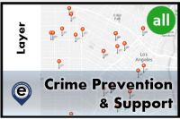 Crime Prevention and Support
Locations of offices providing crime prevention and support in Los Angeles County
Type: Feature Service
Last Modified: April 18, 2022
 Crime Analysis
Crime Analysis can be used to enhance public safety, identify emerging trends, organize law enforcement operations, and plan crime-prevention strategies.
Type: Solution
Last Modified: March 6, 2024
 Property Crime Data Layer - Coquitlam
This feature service contains a property crime instance layer to support the Property Crime Dashboard project for the City of Coquitlam.
Type: Feature Service
Last Modified: August 9, 2023


