Resources
 Protected area with sustainable use of natural resources (PADUS)
The PAD-US geodatabase was originally developed to organize and assess the management status (i.e. apply 'GAP Status Code') of elements of biodiversity protection by identifying species and plant communities not adequately represented in existing conservation lands ( https://www.usgs.gov/core-science-systems/science-analytics-and-synthesis/gap ). In cooperation with the United Nations Environment Programme World Conservation Monitoring Centre (UNEP-WCMC), PAD-US also supports global conservation analyses to inform policy decisions ( https://www.protectedplanet.net/country/USA , https://www.protectedplanet.net/en/resources/global-reports ). The dataset is robust and has been expanded in recent years with major additions of local parks data to PAD-US 2.1, to support the recreation, natural resource management, wildfire planning, emergency management, transportation, research, and public health communities. New applications of the data are frequently discovered. Multiple attributes and a flexible database structure provide context for data to be used at local, regional, state, national, and international scales. See https://www.usgs.gov/gapanalysis/PAD-US-resources for more information.
Type: Feature Service
Last Modified: June 29, 2023
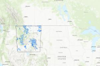
 Wildlife Protection Overlay
Created Using the Idaho Crucial Habitat layer and clipping it to the area of impact for Kootenai County, Idaho. The PAD-US geodatabase was originally developed to organize and assess the management status (i.e. apply 'GAP Status Code') of elements of biodiversity protection by identifying species and plant communities not adequately represented in existing conservation lands. In cooperation with the United Nations Environment Programme World Conservation Monitoring Centre (UNEP-WCMC), PAD-US also supports global conservation analyses to inform policy decisions. The dataset is robust and has been expanded in recent years, culminating in major additions to PAD-US 2.1, to support the recreation, natural resource management, wildfire, emergency management, transportation, research, and public health communities. New applications are frequently discovered. Multiple attributes and a flexible database structure provide context for data to be used at local (depending on inventory completeness in the local area), regional, state, national, and international scales. See https://usgs.gov/gapanalysis/PAD-US-resources for more information.
Type: Feature Service
Last Modified: December 16, 2021
 Protected Areas Database
The PAD-US geodatabase was originally developed to organize and assess the management status (i.e. apply 'GAP Status Code') of elements of biodiversity protection by identifying species and plant communities not adequately represented in existing conservation lands ( https://www.usgs.gov/core-science-systems/science-analytics-and-synthesis/gap ). In cooperation with the United Nations Environment Programme World Conservation Monitoring Centre (UNEP-WCMC), PAD-US also supports global conservation analyses to inform policy decisions ( https://www.protectedplanet.net/country/USA , https://www.protectedplanet.net/en/resources/global-reports ). The dataset is robust and has been expanded in recent years with major additions of local parks data to PAD-US 2.1, to support the recreation, natural resource management, wildfire planning, emergency management, transportation, research, and public health communities. New applications of the data are frequently discovered. Multiple attributes and a flexible database structure provide context for data to be used at local, regional, state, national, and international scales. See https://www.usgs.gov/gapanalysis/PAD-US-resources for more information.
Type: Feature Service
Last Modified: September 22, 2023
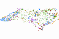 North Carolina Natural Heritage Program Managed Areas
The North Carolina Natural Heritage Program's Managed Areas are a collection of properties and easements where natural resource conservation is one of the primary management goals or are of conservation interest.
Type: Map Service
Last Modified: January 29, 2024
 Protected landscape or seascape (PADUS)
The PAD-US geodatabase was originally developed to organize and assess the management status (i.e. apply 'GAP Status Code') of elements of biodiversity protection by identifying species and plant communities not adequately represented in existing conservation lands ( https://www.usgs.gov/core-science-systems/science-analytics-and-synthesis/gap ). In cooperation with the United Nations Environment Programme World Conservation Monitoring Centre (UNEP-WCMC), PAD-US also supports global conservation analyses to inform policy decisions ( https://www.protectedplanet.net/country/USA , https://www.protectedplanet.net/en/resources/global-reports ). The dataset is robust and has been expanded in recent years with major additions of local parks data to PAD-US 2.1, to support the recreation, natural resource management, wildfire planning, emergency management, transportation, research, and public health communities. New applications of the data are frequently discovered. Multiple attributes and a flexible database structure provide context for data to be used at local, regional, state, national, and international scales. See https://www.usgs.gov/gapanalysis/PAD-US-resources for more information.
Type: Feature Service
Last Modified: June 29, 2023
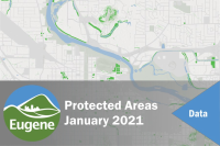 Protected Areas January 2021
Protected land is reserved to protect natural resources or because of natural hazards and therefore is assumed to have no development or redevelopment potential.
Type: Feature Service
Last Modified: January 6, 2024
 Protected Areas Database of the United States (PAD-US)
The PAD-US geodatabase was originally developed to organize and assess the management status (i.e. apply 'GAP Status Code') of elements of biodiversity...
Type: Feature Service
Last Modified: April 11, 2021
 Protected_Areas_20160505_Umatilla
Protected Areas (Land Management Designations) for Umatilla County Risk MAP project portfolio. Purpose: The mission of the USGS Gap Analysis Program (GAP) is providing state, regional and national assessments of the conservation status of native vertebrate species and natural land cover types and facilitating the application of this information to land management activities. The PAD-US geodatabase is required to organize and assess the management status (i.e. apply GAP Status Codes) of elements of biodiversity protection. The goal of GAP is to 'keep common species common' by identifying species and plant communities not adequately represented in existing conservation lands. Common species are those not currently threatened with extinction. By identifying their habitats, gap analysis gives land managers and policy makers the information they need to make better-informed decisions when identifying priority areas for conservation. In cooperation with UNEP-World Conservation Monitoring Centre, GAP ensures PAD-US also supports global analyses to inform policy decisions by maintaining World Database for Protected Areas (WDPA) Site Codes and data for International Union for the Conservation of Nature (IUCN) categorized protected areas in the United States. GAP seeks to increase the efficiency and accuracy of PAD-US updates by leveraging resources in protected areas data aggregation and maintenance as described in "A Map of the Future", published following the PAD-US Design Project (July, 2009) available at: http://gapanalysis.usgs.gov/padus/vision/ with updates coming soon. While PAD-US was originally developed to support the GAP Mission stated above, the dataset is robust and has been expanded to support the conservation, recreation and public health communities as well. Additional applications become apparent over time. See the GAP Website http://gapanalysis.usgs.gov/padus/resources/ or the companion site http://protectedlands.net/uses for more information.
Type: Feature Service
Last Modified: January 8, 2022
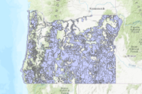
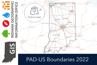 Protected Area Database Boundaries 2022
The PAD-US geodatabase was originally developed to organize and assess the management status (i.e. apply 'GAP Status Code') of elements of biodiversity protection by identifying species and plant communities not adequately represented in existing conservation lands ( https://www.usgs.gov/core-science-systems/science-analytics-and-synthesis/gap ). In cooperation with the United Nations Environment Programme World Conservation Monitoring Centre (UNEP-WCMC), PAD-US also supports global conservation analyses to inform policy decisions ( https://www.protectedplanet.net/country/USA , https://www.protectedplanet.net/en/resources/global-reports ). The dataset is robust and has been expanded in recent years with major additions of local parks data to PAD-US 2.1, to support the recreation, natural resource management, wildfire planning, emergency management, transportation, research, and public health communities. New applications of the data are frequently discovered. Multiple attributes and a flexible database structure provide context for data to be used at local, regional, state, national, and international scales. See https://www.usgs.gov/gapanalysis/PAD-US-resources for more information.
Type: Feature Service
Last Modified: April 16, 2024
 Land Ownership
The PAD-US geodatabase was originally developed to organize and assess the management status (i.e. apply 'GAP Status Code') of elements of biodiversity protection by identifying species and plant communities not adequately represented in existing conservation lands ( https://www.usgs.gov/core-science-systems/science-analytics-and-synthesis/gap ). In cooperation with the United Nations Environment Programme World Conservation Monitoring Centre (UNEP-WCMC), PAD-US also supports global conservation analyses to inform policy decisions ( https://www.protectedplanet.net/country/USA , https://www.protectedplanet.net/en/resources/global-reports ). The dataset is robust and has been expanded in recent years with major additions of local parks data to PAD-US 2.1, to support the recreation, natural resource management, wildfire planning, emergency management, transportation, research, and public health communities. New applications of the data are frequently discovered. Multiple attributes and a flexible database structure provide context for data to be used at local, regional, state, national, and international scales. See https://www.usgs.gov/gapanalysis/PAD-US-resources for more information.
Type: Feature Service
Last Modified: May 23, 2023


