Resources
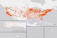
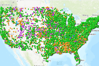
 Power Plants
This feature class/shapefile is for the Homeland Infrastructure Foundation Level Database (HIFLD) https://gii.dhs.gov/HIFLD as well as the Energy modelling and simulation community.
Type: Feature Service
Last Modified: December 11, 2023
 GasFired Power Plants
This feature class/shapefile is for the Homeland Infrastructure Foundation Level Database (HIFLD) (https://gii.dhs.gov/HIFLD) as well as the Energy modelling and simulation community.
Type: Feature Service
Last Modified: July 8, 2021
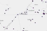 Power Plants
This feature class/shapefile is for the Homeland Infrastructure Foundation Level Database (HIFLD) (https://gii.dhs.gov/HIFLD) as well as the Energy modelling and simulation community. Data has been subset to the greater Chattanooga region.
Type: Feature Service
Last Modified: February 8, 2024
 VA_plants_EIA
This feature class/shapefile is for the Homeland Infrastructure Foundation Level Database (HIFLD) (https://gii.dhs.gov/HIFLD) as well as the Energy modelling and simulation community.
Type: Feature Service
Last Modified: May 2, 2022
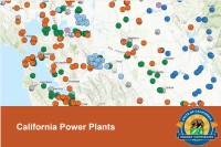 California Power Plants
Power plant locations and characteristics as recorded in the Quarterly Fuel and Energy Report (QFER) database from the California Energy Commission (CEC). Last updated in May 2023
Type: Feature Service
Last Modified: November 16, 2023
 Statewide Power Outages (Public View)
California Governor's Office of Emergency Services (Cal OES) Tracked Power Outage information for California. Updated every 15 Minutes
Type: Feature Service
Last Modified: September 20, 2023
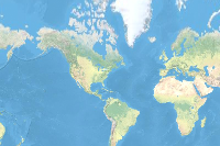
 Environmental Protection Agency (EPA) Facility Registry Service (FRS) Power Plants
Type: Feature Service
Last Modified: March 20, 2020
 GIC7 Average annual daily potential wind energy (kWh/m2/day)
This EnviroAtlas web service includes layers depicting EnviroAtlas national metrics mapped at the 12-digit HUC within the conterminous United States, Alaska, Hawaii, Puerto Rico, and the U.S. Virgin Islands.
Type: Map Service
Last Modified: April 8, 2020
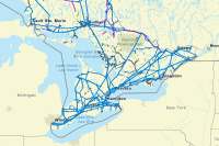 Ontario Utility Lines
This dataset displays Ontario's utility lines that provide services for power, water, communications and heating fuel.
Type: Feature Service
Last Modified: October 25, 2021
 National Disaster Debris Recovery Facilities (EPA 2023)
This EPA content item contains national-scale Disaster Debris Recovery Data for the United States. These vector data were organized to promote the proper recovery, recycling, and disposal of disaster debris management.
Type: Feature Service
Last Modified: February 1, 2024
 FAC - National Disaster Debris Recovery Facilities (EPA)
This SEGS content item contains national-scale Disaster Debris Recovery Data for the United States. These vector data were organized to promote the proper recovery, recycling, and disposal of disaster debris
Type: Feature Service
Last Modified: September 7, 2021
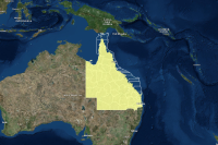
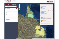 Disaster Recovery Funding Arrangements Active Activations Application
This web application service is designed to provide a public access with the information relevant to Activations in relation to the Disaster Recovery Funding Arrangements.
Type: Web Experience
Last Modified: March 20, 2024
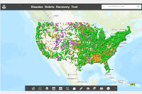
 Map - Disaster Debris Recovery Tool
This is the web map for the Disaster Debris Recovery Tool (DDRT).
Type: Web Map
Last Modified: February 7, 2023
 Disaster Recovery Funding Arrangements Active Activations Web Map
Web Map of Active Activations for disaster funding under the Disaster Recovery Funding Arrangements (DRFA). Servicing
Type: Web Map
Last Modified: March 20, 2024
 Disaster Recovery Centers
Active Disaster Recovery Centers. The data is from the DRC Manager program and is updated every hour.
Type: Map Service
Last Modified: July 9, 2020
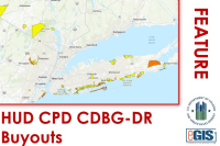 HUD CPD CDBG - Disaster Recovery Buyouts
The data demonstrates the location of CDBG-DR-funded buyout activities as part of the Office of Community Planning and Development's (CPD) Disaster Recovery Buyout Program. The data is derived from an extract of HUD CPD’s Disaster Recovery Grants Reporting (DRGR) System, an address-level dataset that includes Community Development Block Grant – Disaster Recovery activities for certain grantees and over a limited span of time during which grantees were required to report addresses of certain funded activities. Buyouts are a unique disaster-related activity made eligible through a waiver in the allocation of CDBG-DR grants following a natural hazard disaster. Under the waiver, grantees are permitted to use CDBG-DR funds to pay the pre-disaster or post-disaster value to acquire properties impacted by a natural hazard, usually flooding, for the purpose of risk reduction.
Type: Feature Service
Last Modified: January 31, 2024
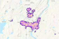 Black Marble High Definition in Maine, USA due to major storm event in December 2023
Black Marble High Definition in Maine, USA due to major storm event in December 2023
Type: Map Service
Last Modified: January 2, 2024
 Common Operating Picture: FEMA DR-4652-NM (ExperienceBuilder)
The Common Operating Picture for DR-4652-NM (NM 2022 Wildfire and Monsoon Season) is a single-stop for response, recovery, and mitigation data across impacted communities. This application allows for users to explore the disaster, and the efforts taking place to restore impacted communities within New Mexico.
Type: Web Experience
Last Modified: October 18, 2023
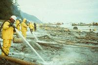 The Oil Pollution Act of 1990: 30 Years of Spills
Examining OPA's Legacy Through 30 Years of Oil Spill Response, Assessment, and Restoration
Type: StoryMap
Last Modified: August 18, 2020


