Resources
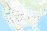
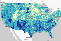 FEMA Community Resilience Challenges Index (CRCI) Counties
Counties - FEMA Community Resilience Challenges Index (CRCI) - Percentile: Composite of 22 CRCI Indicators
Type: Feature Service
Last Modified: May 17, 2023
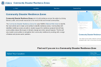
 FEMA Community Disaster Resilience Zones
Users of the FEMA Community Disaster Resilience Zones data will be able to identify where Community Disaster Resilience Zones exist. This layer was created by FEMA Headquarters to target Census tracts identified as disadvantaged communities most at-risk to natural hazards as a part of the Community Disaster Resilience Zones Act.
Type: Feature Service
Last Modified: April 4, 2024
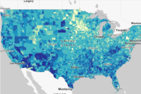 FEMA Community Resilience Challenges Index (CRCI) Census Tracts
This layer of census tracts contains the FEMA Community Resilience Challenges Index (CRCI) information. The layer displays the CRCI Percentile, which is a composite of 22 CRCI indicators.
Type: Feature Service
Last Modified: May 17, 2023
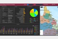 RQI Regional Resilience Strategy Action Plans
This web app is an OPS Dashboard supporting the objective of the NDRP to reduce Queensland communities’ vulnerability to natural disasters and build community resilience.
Type: Dashboard
Last Modified: October 17, 2022
 FEMA Community Disaster Resilience Zones
A web map containing FEMA Community Disaster Resilience Zones data, alongside other supplementary information such as Census boundaries.
Type: Web Map
Last Modified: November 14, 2023
 FEMA Community Disaster Resilience Zones Viewer
Users of the FEMA Community Disaster Resilience Zones application will be able to identify where Community Disaster Resilience Zones exist. This application uses the FEMA Community Disaster Resilience Zones layer created by FEMA Headquarters, which was created to target Census tracts identified as disadvantaged communities most at-risk to natural hazards as a part of the Community Disaster Resilience Zones Act.
Type: Web Experience
Last Modified: October 31, 2023
 FEMA Community Disaster Resilience Zones
Users of the FEMA Community Disaster Resilience Zones application will be able to identify where Community Disaster Resilience Zones exist. This application uses the FEMA Community Disaster Resilience Zones layer created by FEMA Headquarters, which was created to target Census tracts identified as disadvantaged communities most at-risk to natural hazards as a part of the Community Disaster Resilience Zones Act.
Type: Web Experience
Last Modified: September 13, 2023
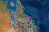 Natural Disaster Resilience Program 2017-18
Project details and broad locations of the $14.3 million 2017-2018 Natural Disaster Resilience Program (NDRP). The NDRP is aimed at reducing Queensland communities vulnerability to natural disasters.
Type: Map Service
Last Modified: March 4, 2024
 FEMA Community Disaster Resilience Zones
A dashboard where users can select their State/Territory and County/County Equivalent to see if they are in a Community Disaster Resilience Zone.
Type: Dashboard
Last Modified: August 25, 2023
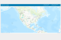
 Resilience Analysis and Planning Tool (RAPT)
The FEMA and Argonne created the Resilience Analysis and Planning Tool (RAPT) to support state, local, tribal, territorial analysis in identifying focus areas for building resilience and response capabilities.
Type: Web Mapping Application
Last Modified: March 21, 2024


