Resources
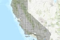
 CGS Seismic Hazards Program: Landslide Zones (DOC Hosted)
The map is used by cities and counties to regulate development and by property owners selling property within areas where seismic hazard zones have been identified. Local governments can withhold development permits until geologic or soils investigations are conducted for specific sites and mitigation measures are incorporated into development plans. Sellers of property use the maps to check the location of their specific site and, if applicable, disclose to the buyer that the property lies within a seismic hazard zone as required by the Seismic Hazards Mapping Act of 1990 (Public Resources Code, Division 2, Chapter 7.8). For information regarding the scope and recommended methods to be used in conducting the required site investigations, see California Geological Survey Special Publication 117A, Guidelines for Evaluating and Mitigating Seismic Hazards in California.
Type: Map Service
Last Modified: April 11, 2022
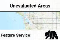
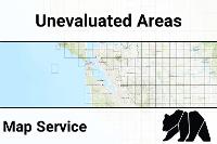 CGS Seismic Hazards Program: Unevaluated Areas
The map is used by cities and counties to regulate development and by property owners selling property within areas where seismic hazard zones have been identified. Local governments can withhold development permits until geologic or soils investigations are conducted for specific sites and mitigation measures are incorporated into development plans. Sellers of property use the maps to check the location of their specific site and, if applicable, disclose to the buyer that the property lies within a seismic hazard zone as required by the Seismic Hazards Mapping Act of 1990 (Public Resources Code, Division 2, Chapter 7.8). For information regarding the scope and recommended methods to be used in conducting the required site investigations, see California Geological Survey Special Publication 117A, Guidelines for Evaluating and Mitigating Seismic Hazards in California.
Type: Map Service
Last Modified: April 11, 2022
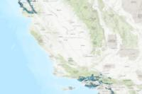
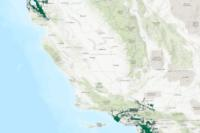
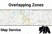 CGS Seismic Hazards Program: Overlapping Landslide and Liquefaction Zones
The map is used by cities and counties to regulate development and by property owners selling property within areas where seismic hazard zones have been identified. Local governments can withhold development permits until geologic or soils investigations are conducted for specific sites and mitigation measures are incorporated into development plans. Sellers of property use the maps to check the location of their specific site and, if applicable, disclose to the buyer that the property lies within a seismic hazard zone as required by the Seismic Hazards Mapping Act of 1990 (Public Resources Code, Division 2, Chapter 7.8). For information regarding the scope and recommended methods to be used in conducting the required site investigations, see California Geological Survey Special Publication 117A, Guidelines for Evaluating and Mitigating Seismic Hazards in California.
Type: Map Service
Last Modified: April 11, 2022
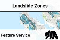
 CGS Seismic Hazards Program: Landslide Zones
The map is used by cities and counties to regulate development and by property owners selling property within areas where seismic hazard zones have been identified. Local governments can withhold development permits until geologic or soils investigations are conducted for specific sites and mitigation measures are incorporated into development plans. Sellers of property use the maps to check the location of their specific site and, if applicable, disclose to the buyer that the property lies within a seismic hazard zone as required by the Seismic Hazards Mapping Act of 1990 (Public Resources Code, Division 2, Chapter 7.8). For information regarding the scope and recommended methods to be used in conducting the required site investigations, see California Geological Survey Special Publication 117A, Guidelines for Evaluating and Mitigating Seismic Hazards in California.
Type: Feature Service
Last Modified: April 11, 2022
 CGS LQLS Overlap
The map is used by cities and counties to regulate development and by property owners selling property within areas where seismic hazard zones have been identified. Local governments can withhold development permits until geologic or soils investigations are conducted for specific sites and mitigation measures are incorporated into development plans. Sellers of property use the maps to check the location of their specific site and, if applicable, disclose to the buyer that the property lies within a seismic hazard zone as required by the Seismic Hazards Mapping Act of 1990 (Public Resources Code, Division 2, Chapter 7.8). For information regarding the scope and recommended methods to be used in conducting the required site investigations, see California Geological Survey Special Publication 117A, Guidelines for Evaluating and Mitigating Seismic Hazards in California.
Type: Feature Service
Last Modified: April 11, 2022
 CGS SHZ Unevaluated Areas
The map is used by cities and counties to regulate development and by property owners selling property within areas where seismic hazard zones have been identified. Local governments can withhold development permits until geologic or soils investigations are conducted for specific sites and mitigation measures are incorporated into development plans. Sellers of property use the maps to check the location of their specific site and, if applicable, disclose to the buyer that the property lies within a seismic hazard zone as required by the Seismic Hazards Mapping Act of 1990 (Public Resources Code, Division 2, Chapter 7.8). For information regarding the scope and recommended methods to be used in conducting the required site investigations, see California Geological Survey Special Publication 117A, Guidelines for Evaluating and Mitigating Seismic Hazards in California.
Type: Feature Service
Last Modified: February 21, 2024
 CGS Landslide Zones
The map is used by cities and counties to regulate development and by property owners selling property within areas where seismic hazard zones have been identified. Local governments can withhold development permits until geologic or soils investigations are conducted for specific sites and mitigation measures are incorporated into development plans. Sellers of property use the maps to check the location of their specific site and, if applicable, disclose to the buyer that the property lies within a seismic hazard zone as required by the Seismic Hazards Mapping Act of 1990 (Public Resources Code, Division 2, Chapter 7.8). For information regarding the scope and recommended methods to be used in conducting the required site investigations, see California Geological Survey Special Publication 117A, Guidelines for Evaluating and Mitigating Seismic Hazards in California.
Type: Feature Service
Last Modified: February 21, 2024
 CGS Liquefaction Zones
The map is used by cities and counties to regulate development and by property owners selling property within areas where seismic hazard zones have been identified. Local governments can withhold development permits until geologic or soils investigations are conducted for specific sites and mitigation measures are incorporated into development plans. Sellers of property use the maps to check the location of their specific site and, if applicable, disclose to the buyer that the property lies within a seismic hazard zone as required by the Seismic Hazards Mapping Act of 1990 (Public Resources Code, Division 2, Chapter 7.8). For information regarding the scope and recommended methods to be used in conducting the required site investigations, see California Geological Survey Special Publication 117A, Guidelines for Evaluating and Mitigating Seismic Hazards in California.
Type: Feature Service
Last Modified: February 21, 2024
 CGS Seismic Hazards Program: Unevaluated Areas
The map is used by cities and counties to regulate development and by property owners selling property within areas where seismic hazard zones have been identified. Local governments can withhold development permits until geologic or soils investigations are conducted for specific sites and mitigation measures are incorporated into development plans. Sellers of property use the maps to check the location of their specific site and, if applicable, disclose to the buyer that the property lies within a seismic hazard zone as required by the Seismic Hazards Mapping Act of 1990 (Public Resources Code, Division 2, Chapter 7.8). For information regarding the scope and recommended methods to be used in conducting the required site investigations, see California Geological Survey Special Publication 117A, Guidelines for Evaluating and Mitigating Seismic Hazards in California.
Type: Feature Service
Last Modified: April 11, 2022
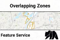 CGS Seismic Hazards Program: Overlapping Landslide and Liquefaction Zones
The map is used by cities and counties to regulate development and by property owners selling property within areas where seismic hazard zones have been identified. Local governments can withhold development permits until geologic or soils investigations are conducted for specific sites and mitigation measures are incorporated into development plans. Sellers of property use the maps to check the location of their specific site and, if applicable, disclose to the buyer that the property lies within a seismic hazard zone as required by the Seismic Hazards Mapping Act of 1990 (Public Resources Code, Division 2, Chapter 7.8). For information regarding the scope and recommended methods to be used in conducting the required site investigations, see California Geological Survey Special Publication 117A, Guidelines for Evaluating and Mitigating Seismic Hazards in California.
Type: Feature Service
Last Modified: April 11, 2022


