Information must be curated, managed and shared by Public Safety Agencies with the community. GIS is a powerful way to tell the public safety story in a community. During an incident, this information can be rapidly shared with media and the public to convey evolving situations. It can be used to communicate evacuation areas, shelter locations, and detailed recovery information.
CrawlMaps presenting information that have been printed to summarize incident information. It important to time stamp static maps and provide a link for updates. Public Information Officers often use free and public domain web maps to print them with information that represents the incident. |
WalkPrinted mapping + soft copy (pdf) and web mapping versions of the same information. Many of these maps convey information with scale-dependant rendering (more info the closer you zoom in). Core information for the public includes evacuation notices, open shelters, and road status. |
RunPublic Information Maps that allow the PIO to constantly update the public with core information needs. This is done by integrating internal incident data with a filtered, live public view of the same information. The PIO integrates their maps with social media and/or embedded into agency website. |
| Example: Public Information Maps at ArcGIS Online | Example: Public Information Maps at ArcGIS Online | Example: Public Information Maps at ArcGIS Online |
More Resources
UPDATE Here are two presentations on how to get started with Public Information Maps.
GIS Specialists Start Here: Situational Awareness for the Living Room
Public Information Officers Start Here: The Innovative PIO
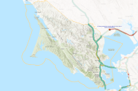
 Mariposa County Public Information Map
The Mariposa County Public Information Map is designed to assist both residents and visitors by providing essential public safety information. It proves valuable for verifying the current status and whereabouts of publicly relevant details, including but not restricted to Evacuation Zones, Road Closures, and Active Fires. This comprehensive Public Information Map (PIM) displays local power outages, evacuation zones, fire perimeters, road closures, and other public safety hazards within Mariposa County. Utilize this map as a reliable point of reference, while also prioritizing compliance with directives from local law enforcement agencies for utmost safety.
Type: Web Mapping Application
Last Modified: April 12, 2024
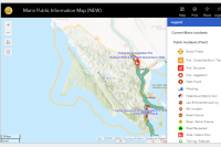
 Marin Public Information Map
This map contains information from sources within the county including cities / towns / agencies, external providers such as NWS, CalFire, PG&E, and intended primarily to provide situational awareness to the residents & visitors of Marin. This is especially the case during an incident or disaster. While this map is primarily intended to be used by the public, it may also be used by internal users. This map has a subset of what is available on the Internal SA / COP map.
Type: Web Map
Last Modified: April 19, 2024
 Marin Public Information Tool
This tool contains information from sources within the county including cities / towns / agencies, external providers such as NWS, CalFire, PG&E, and intended primarily to provide situational awareness to the residents & visitors of Marin. This is especially the case during an incident or disaster. While this tool is primarily intended to be used by the public, it may also be used by internal users. This map has a subset of what is available on the Internal SA / COP map.
Type: Web Experience
Last Modified: March 21, 2024
 CDEM Public Information (View)
CDEM Public Information
Type: Feature Service
Last Modified: June 23, 2023
 Public Information
Public Information is a source for authoritative information from Teton County WY Emergency Management regarding evacuations and other significant incidents.
Type: Web Mapping Application
Last Modified: August 30, 2023
 Fort McMurray Wildfires Public Information App
Web Application showing wildfires in Alberta, and related social media
Type: Web Mapping Application
Last Modified: February 15, 2018
 Boulder Emergency Operations - Public Information Map
Information in this map is compiled using the best available data provided by emergency responders. During an emergency event, information can change rapidly. This map will be updated throughout the event as new information is provided.
Type: Web Mapping Application
Last Modified: May 16, 2023
 Information
This is a vector point feature class that represents select information points managed by Jefferson County Open Space
Type: Feature Service
Last Modified: November 29, 2022
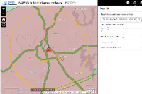 NAPSG Public Information Map
NAPSG Public Information Map (Prototype) - Web Mapping Application.
Type: Web Mapping Application
Last Modified: May 12, 2020
 Public Information
Web application to provide citizens within Douglas County, CO the most up-to-date information related to active emergency events.
Type: Web Mapping Application
Last Modified: January 11, 2022


