A common operating picture is a web based platform for fusing, analyzing and viewing key information sources decision makers need to plan for, respond to and recover from emergency incidents. Public safety professionals are often called upon to make rapid decisions in critical circumstances based on the best available information at the time. This usually requires the synthesis of data from many different sources. A law enforcement official responding to a homicide in a vacant structure might need to fuse multiple sources of data to determine the incident history in the location of the building. A fire officer responding to smoke showing in a warehouse needs to decide quickly whether to send his firefighters into the building or mount a defensive attack. Responding officers to either of these scenarios might need to know the building construction type, who might be in the structure, whether there are open warrants at that location, whether repeat calls have come from the location, etc. A well designed common operating picture can provide such information when, where and to whom it is needed.
CrawlPaper mapping is often the first product a Public Safety agency uses to gain insight into Situational Awareness. Many times, agencies will develop basemaps and/or preplan products that they will then use to mark up during an incident. This information can be communicated with other units by taking photos of the maps and sending them, or (more commonly), delivering the mark ups to a GIS Specialist supporting the incident in order to capture the information and begin to transfer it to other field and command and control elements. |
WalkThe next phase of the Situational Awareness map is a web map that is able to be updated by the GIS specialist supporting the incident. This map is an improvement because it speeds the information distribution to those that need it by removing the artificiality of data creation and re-digitization seen in the paper map creation process. |
RunSituational Awareness at its pinnacle is much more than layers on a map describing the current situation. It becomes a well-organized fabric of data that is very selectively contributing to the picture. It is a system that understands the user, his or her context and role, and tailors information to that person (in that place). It is more accurately described at this level as Decision Support rather than a Common Operating Picture. It is integrated with CAD, RMS, AVL and Staffing/Resource systems. It is also interactive and updated with field units. As an example, the National Interagency Fire Center uses the Enterprise Geospatial Portal (EGP) this way. It combines all strategic and tactical information into once system used by all levels of response and overhead. |
| Example: NOAA Maps Pollution Response | Example: FEMA Maps 2013 Colorado Floods | Example: NIFC Uses Data to Fight Fires |
More Resources
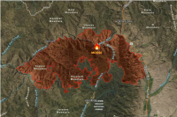
 Cal PreP - Fire Awareness Map
The California Governor’s Office of Emergency Services’ (Cal OES) Cal Prep Fire Situation Awareness app provides an overview of fires, weather conditions and potential impacts in California.
Type: Web Mapping Application
Last Modified: September 8, 2021
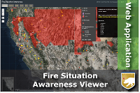
 NAPSG Situational Awareness Viewer
This Situational Awareness Viewer provides an example of how geospatial tools can be configured by technologists to support public safety decision-making. It combines live feeds, incident data, and base data identified as core information.
Type: Web Mapping Application
Last Modified: April 10, 2024
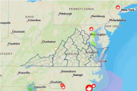 Virginia Situational Awareness
Situational awareness across the Commonwealth of Virginia
Type: Web Map
Last Modified: May 18, 2023
 Situational Awareness
Situational Awareness data and symbology.
Type: Feature Service
Last Modified: March 17, 2017
 NAPSG Situational Awareness Web Map
NAPSG Situational Awareness Web Map template.
Type: Web Map
Last Modified: April 3, 2024
 Situational Awareness Map
Map showing hazards, facilities, and infrastructure used in the Situational Awareness Viewer configuration.
Type: Web Map
Last Modified: August 2, 2018
 Wildfire Aware Incident, Population, and Environment Enriched Layer
This layer, maintained for use in the Wildfire Aware application, provides a live feed of current wildfire locations and perimeters sourced from the USA Current Wildfires layer and enriched with summaries of key population and environment information.
Type: Feature Service
Last Modified: April 25, 2024
 Situational Awareness Viewer for Narragansett, RI
The data displayed represents a situational awareness view of Narragansett, RI based on Category 1-2 hurricane evacuation zones.
Type: Web Mapping Application
Last Modified: July 30, 2017
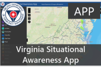 Virginia Situational Awareness Application
The publicly available Virginia Situational Awareness application displays spatially referenced information in to help improve all-hazards situational awareness across all phases of emergency management.
Type: Web Experience
Last Modified: August 16, 2023
 Situational Awareness Web Map of Fire Hazard in San Diego County, USA (Exercise Only)
This is a situational awareness map for fire hazard in San Diego County.
Type: Web Map
Last Modified: August 14, 2016


