Creating a solid GIS for Public Safety isn’t all about incidents and situational awareness. Fundementally, the Public Safety Enterprise is about managing information. Good knowledge management is a cornerstone of protecting and serving the community life, property, and well being. Inventory and asset management run the gamut from inter-departmental logistics to tracking resources and activity in the community.
CrawlHard copy mapping of various inventory and assets in a Public Safety agency is very helpful. It allows you to see where your key resources and capabilities are deployed. Further, this look at an agency helps decision makers evaluate future needs and/or deployment patterns. Where are my stations, where are my key peices of apparatus, where are my sectors and boundaries, do they have enough resources to serve thier areas? This mapping can serve as an input for Capability Assessment. |
WalkUsing very well structured data templates like the Local Government Information Model is a very good way to create and maintain foundational data that is important to Public Safety. Using a standard data model and symbology like this is an excellent way to create interoperability with other Local agencies who will lend you support with this base GIS data. |
RunUsing the Local Government Information Model allows you to create mobile applications with which staff can create and maintain important data for your Public Safety organization. This data allows easy maintenance and update of critical infrastructure, inspection, enforcement, and land records data and is the foundation of products that agencies use to add call data and resource information as well as foundational and dynamic analysis. |
| Example: Search Local Government at ArcGIS Online | Example: Local Government at ArcGIS Online | Example: Kentucky Mutual Aid Support System |
More Resources
 Certified Local Government Cities
The Certified Local Government Program is a local, state, and federal government partnership to empower local communities to better protect historic resources by identifying local priorities and providing access to financial and technical services.
Type: Feature Service
Last Modified: September 29, 2022
 Certified Local Government Counties
The Certified Local Government Program is a local, state, and federal government partnership to empower local communities to better protect historic resources by identifying local priorities and providing access to financial and technical services.
Type: Feature Service
Last Modified: February 7, 2023
 Local Governments
Entity boundaries based on Local Governance and Local Government Reform (LGLGR), New Brunswick Department of Environment and Local Government. Limites des entités basées sur le projet de communauté durable 2022, ministère de l'Environnement et des Gouvernements locaux du Nouveau-Brunswick.
Type: Feature Service
Last Modified: December 16, 2022
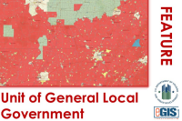 Unit of General Local Government (UGLG)
This dataset symbolizes city, county, town, parish, village, or other general-purpose political subdivisions of a State. The term "Unit of General Local Government" refers to a city, county, town, parish, village, or other general-purpose political subdivision of a State. Units of General Local Government (UGLG) are comprised of several Census geographies including: Summary Level 050 - State-County; Summary Level 060 - County Subdivision; Summary Level 070 - State-County-County Subdivision-Place/Remainder; Summary Level 160 - Place; Summary Level 170 - State-Consolidate City; Remainders of County Lands.
Type: Feature Service
Last Modified: February 2, 2024
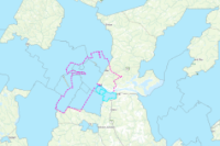
 The City of Sydney Local Government Area
The City of Sydney's local government area boundary.
Type: Feature Service
Last Modified: January 17, 2023
 State Government Local Government Area
Authoritative LGA layer from Queensland State Government
Type: Feature Service
Last Modified: December 11, 2023
 geonb_Local_Governments_Gouvernements_locaux
Entity boundaries based on Local Government and Local Governance Reform (LGLGR), New Brunswick Department of Environment and Local Government. Entity boundaries are subject to change. Limites des entités basées sur Gouvernements locaux et de la Réforme de la gouvernance locale, ministère de l'Environnement et des Gouvernements locaux du Nouveau-Brunswick. Les limites des entités peuvent changer.
Type: Feature Service
Last Modified: April 3, 2023
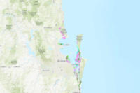 SEQ Region Catchments and Local Government Areas
South East Queensland Local Government Areas including Toowoomba Urban Footprint, combined with the South East Queensland NRM Catchment boundary. This is the combined area reported on by the SEQ NRM Plan.
Type: Feature Service
Last Modified: October 2, 2023
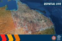 QSpatial Queensland Local Government Areas
The Local Government Area boundaries (LGA) dataset provides the map base of Local Government Areas in Queensland sourced from DNRME servers direct.
Type: Feature Service
Last Modified: December 9, 2022
 Queensland Local Government Areas
The spatial representation of local government areas in Queensland.
Type: Feature Service
Last Modified: November 7, 2016


