Working with Training Staff and Exercise planners allows organizations to augment these activities with visual and mapping support.
CrawlGIS is ideally suited to support both Training and Excercises within a Public Safety Agency. The first step in developing this capability in your organization is to use paper maps that visualize the scenario you are training or excercising on. Floods, wildfires, floorplans for active shooters, etc give participants visuals by which to orient to the situation and respond. This is an excellent way to provide different groups subsets of information they might have during an actual event. These maps can also be presented as slides allowing training staff to progress through an event and provide injects into the scenario that need to be emphasized. |
WalkCreating and referencing the scenario information in an online format allows participants to ‘touch’ the information directly. Zooming and panning lets the group focus on the portion of the event they need to focus on. It allows them (or the coordinator) to highlight information or areas that require the focus of the group. This is also an excellent way to walk through an After Action Review of real-life events that can be used as training for the entire organization and/or community. In this way, Public Safety Agencies can excercise and train together visualizing how each of their actions contributes to desired outcomes. |
RunIdeally, the use of online/mobile GIS for training and excercising will happen in the same system First Responders and Emergency Managers will use on the day of the actual event. Training through scenarios – where field units can edit the scenario (drawing fire perimeters, setting road blocks, etc) creates situational awareness and safety. Training on a system like this creates strong incident coordination and avoids the inevitable delays that come when Public Safety Agencies use systems that they expect only to use during emergencies. |
| Example: Flood Planning at ArcGIS Online | Example: Special Event Planning at ArcGIS Online | Example: National Interagency Fire Enterprise Geospatial Portal |
More Resources
 Special Event Planning
The Special Event Planning Map organizes special event planning and resource assignment data.
Type: Feature Service
Last Modified: May 7, 2019
 Special Event Planning Croke Park
Special Event Planning Corke Park
Type: Feature Service
Last Modified: March 21, 2023
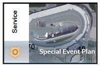 Special Event Plan
The Special Event Planning Map organizes special event planning and resource assignment data.
Type: Feature Service
Last Modified: October 25, 2014
 Special Event Planning
The Special Event Planning Map organizes special event planning and resource assignment data.
Type: Feature Service
Last Modified: February 12, 2014
 Special Event Operations
Special Event Operations can be used to develop safety plans and monitor public safety operations during a special event.
Type: Solution
Last Modified: March 6, 2024
 Special Event Planning
The Special Event Planning map is used by mapping technicians in public safety, emergency management, public works, or planning departments to collect and maintain special event plans and publish special event maps.
Type: Document Link
Last Modified: April 9, 2015
 Special Event Planning Marathon Time Table
Special Event Planning for SSE Airtricty Dublin Marathon Route Time Table
Type: Feature Service
Last Modified: October 25, 2019
 Special Event Planning - Jazz Festival
Special Event Planning - Jazz Festival
Type: Web Map
Last Modified: September 17, 2012
 Special Event Permitting and Operations
Special Event Permitting and Operations can be used to manage special event permits, protect event attendees, and promote special events occurring in the community.
Type: Solution
Last Modified: March 6, 2024
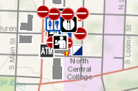
 Ribfest 2021-07-24 - Special Event Safety Resources
A map used in the Special Event Safety Dashboard application to view planned locations of public safety staff and their current locations.
Type: Web Map
Last Modified: July 27, 2020


