Considerations for Debris Management vary based on disaster type (man made, natural disaster) but all use GIS to support them. Typically, debris removal focuses on type of collection and disposal methods used, locations for debris, transportation issues related to hauling, assocated cost tracking, and estimating the speed with which the problem can be addressed.
CrawlPlanning with paper maps is a good place to start – using GIS to identify temporary Debris Removal storage sites depicts locations where agencies can store disaster debris until a later time – for forensics and processing. This planning can include contingincies that are economic too – identifying the need for contracts for hauling to be created ahead of time, and understanding the impact of policies. One example is that FEMA may only pay for the movement of debris once. Large scale disasters may require a GIS support element to be established exclusively for resolving the problems associated with debris management. |
WalkIncorporating the planning analysis into a web-based mapping environment allows a larger audience to understand the two basic problems of debris management; How much and what types of debris are to be removed? And where can the debris be disposed of? When this online environment is established, the incident specific data can begin to be viewed in the context of the planning that has been done. |
RunPerhaps the most powerful contribution GIS makes in this realm is to support modeling the amount of debris. GIS provides models that forcast debris amounts based on the extent of the damage. They consider factors like cubic yards of debris generated per household category per storm, vegetative cover, commercial density, and precipitation. |
| Example: Search Debris at ArcGIS Online | Example: Search Debris at ArcGIS Online | Example: USACE Disaster Impact Models |
More Resources
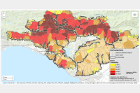
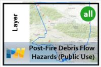 Post-Fire Debris Flow Hazards View (Public Use)
The data in this hosted feature layer view is displayed for public use in the Los Angeles County Public Works Post-Fire Debris Flow Hazards Map: https://apps.gis.lacounty.gov/dpw/m/index.html?viewer=Post-Fire_Debris_Flow_Hazards_Map and can be consumed in other LA County Emergency Viewers.
Type: Feature Service
Last Modified: June 7, 2023
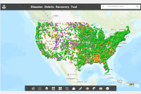 National Disaster Debris Recovery Facilities (EPA 2023)
This EPA content item contains national-scale Disaster Debris Recovery Data for the United States. These vector data were organized to promote the proper recovery, recycling, and disposal of disaster debris management.
Type: Feature Service
Last Modified: February 1, 2024
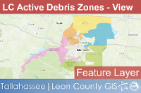 Leon County Active Debris Zones
This feature layer displays Active Debris Management Zones for Leon County, Florida.
Type: Feature Service
Last Modified: March 17, 2023
 USGS 2022 Fire Debris Hazard - Segment Probability Estimates
Emergency Assessment of Post-Fire Debris-Flow Hazards
Type: Feature Service
Last Modified: July 26, 2022
 Marine Debris Removal & Assessment in the Northwestern Hawaiian Islands
2016 Marine Debris Removal and Assessment in the Papahanaumokuakea Marine National Monument, Northwestern Hawaiian Islands, April 12 to May 13, 2016
Type: Web Mapping Application
Last Modified: January 3, 2020
 USGS 2022 Fire Debris Hazard - Debris Basins
Emergency Assessment of Post-Fire Debris-Flow Hazards
Type: Feature Service
Last Modified: July 26, 2022
 Possible_MH370_Debris_Recovered
Possible MH370 Debris Recovered
Type: Feature Service
Last Modified: September 15, 2021
 Landslide Hazards along River Corridors - Shallow Debris Slides Moderate Hazard Potential / lsr_sds_modhazpot_area
Suitable for general reference and analyses. Identifies only areas of potential shallow debris landsliding along the river corridor within the study limits in King County.
Type: Feature Service
Last Modified: December 7, 2018
 Landslide Hazards along River Corridors - Shallow Debris Slides Severe Hazard Potential / lsr_sds_sevhazpot_area
Suitable for general reference and analyses. Identifies only areas of potential shallow debris landsliding along the river corridor within the study limits in King County.
Type: Feature Service
Last Modified: December 1, 2018
 USGS 2022 Fire Debris Hazard - Basin Combined Hazard Estimates
Emergency Assessment of Post-Fire Debris-Flow Hazards
Type: Feature Service
Last Modified: July 26, 2022


