Mitigation comes in many flavors, but using GIS to work on any of them is almost standard these days. GIS supports Risk Assessment, problem depiction, modeling, spatial statistics (helping your find what is meaningful in your data), and most of all – communicating your results to those that can affect outcomes.
CrawlMitigation begins with paper mapping, pattern detection and conversation. Anything you are trying to mitigate needs to be understood first – crime, medical call load, wildfire risk, assets at risk, people in flood plains, or economic impact of natural disasters. Using your agency data, plotting locations of things that contribute to the risk, and printing a simple map that you can discuss with your collegues is a great start. Soon enough, solutions and strategies emerge, and your plan can be mapped too. Over time, tracking your mitigation efforts, the costs involved, and the results becomes a powerful tool for the organization. |
WalkThe next step in the mitigation efforts using GIS is to link your internal data (Records Management Systems, fuels data, inspections, etc) to the GIS. A GIS analyst can work with you to enable this connection. Then the Analysts can automate the analysis you have been doing to understand the problems and depict the results visually. These analytical connections, layers, and its automation should flow into a web-based mapping solution that can function as a ‘dashboard’ for the agency, policy makers, and ultimately transparency in the community. |
RunExpanding the integration of Agency data that contributes to mitigation is an important step. Some agencies implement GIS by acquiring a singe application to address a specific mitigation need – but inderstanding the short and long range needs allows to you expand your mitigation effort within a single platform. The Public Safety mission is complex, as is the information technology environment in which it operates. Planning mitigation efforts with an eye toward system integration allows you to partner, plan and execute prevention and mitigation analysis much more effectively that thinking of these efforts individually. |
| Example: Search Mitigation at ArcGIS Online | Example: Search Mitigation at ArcGIS Online | Example: Search Mitigation at ArcGIS Online |
More Resources
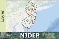 Wildlife Mitigation Sites in New Jersey
The goal of the Road Wildlife Mitigation Database is to serve as a central repository for information on existing and permitted road wildlife mitigation projects in the state of New Jersey. The database is accessible to wildlife biologists, land use planners, transportation planners and engineers working on road wildlife mitigation projects to enable them to see what has been done in the past to inform decisions about future projects. It has tremendous utility as a component of the Division of Fish and Wildlife’s Connecting Habitat Across New Jersey (CHANJ, www.CHANJ.nj.gov) project by improving knowledge sharing and coordination among project planners and engineers across the state regarding increasing safe passage through our road network for wildlife.
Type: Feature Service
Last Modified: January 31, 2024
 Mitigation Target Areas for Interim Mitigation Strategy - 2010 [ds673]
To display Mitigation Target Areas for the Interim Mitigation Strategy.
Type: Feature Service
Last Modified: November 8, 2023
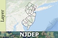
 CDFW Approved Mitigation Service Areas [ds2659]
This data set shows the Service Areas for Mitigation and Conservation Banks for which the California Department of Fish and Wildlife is a signatory. Although attempts have been made to verify all data, there are some Service Areas which may have inaccuracies, especially at the boundaries. Please contact the bank sponsor prior to making plans to purchase credits.
Type: Feature Service
Last Modified: February 8, 2024
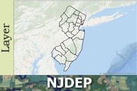
 Conservation and Mitigation Banks [ds2782]
These data represent the mitigation bank locations for banks which are approved by the California Department of Fish and Wildlife. Most of the sites are private property and not open to the to public.
Type: Feature Service
Last Modified: February 8, 2024
 Wetland Mitigation Bank Sites of New Jersey
Wetland mitigation bank data layer was created to provide a graphic representation of the wetland mitigation banks and their associated service areas for use by public, private, and academic entities. It provides a visual approach to identifying the appropriate bank for parties interested in or required to purchase mitigation bank credits or for other parties interested in the wetland banking aspects of the Department’s wetland mitigation program.
Type: Feature Service
Last Modified: November 8, 2021
 Wetland Mitigation Bank Service Areas of New Jersey
Wetland mitigation bank data layer was created to provide a graphic representation of the wetland mitigation banks and their associated service areas for use by public, private, and academic entities. It provides a visual approach to identifying the appropriate bank for parties interested in or required to purchase mitigation bank credits or for other parties interested in the wetland banking aspects of the Department’s wetland mitigation program.
Type: Feature Service
Last Modified: November 8, 2021
 Wetland Mitigation Banks as Points of New Jersey
Wetland mitigation bank data layer was created to provide a graphic representation of the wetland mitigation banks and their associated service areas for use by public, private, and academic entities. It provides a visual approach to identifying the appropriate bank for parties interested in or required to purchase mitigation bank credits or for other parties interested in the wetland banking aspects of the Department’s wetland mitigation program.
Type: Feature Service
Last Modified: November 8, 2021
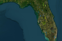 Mining and Mitigation Program (MMP) Map
This web map shows the geographic layers relevant to the Mining and Mitigation Program. More information about this Program can be found at https://floridadep.gov/water/mining-mitigation.
Type: Web Map
Last Modified: February 13, 2023
 Local Mitigation Strategies (LMS) Project List
Local Mitigation Strategies (LMS) data from Miami-Dade County Emergency Management.
Type: Feature Service
Last Modified: October 21, 2019
 NCDOT_Mitigation_Sites
Data showing the location of NCDOT mitigation sites throughout the state of North Carolina. Open in ArcGIS Explorer to use queries. Last Update 04/18/2024.
Type: Feature Service
Last Modified: April 18, 2024


