Computer Aided Dispatch (CAD), Automated Vehicle Location (AVL), and Routing are all examples of dynamic data sources that are routinely integrated with GIS.
CrawlAgencies often extract a snapshot of the data from CAD or RMS to look at the calls and units at a particular time in history. This data can be imported into GIS, geocoded, and used to create mapping that shows patterns, density, and frequency of calls. It is also used to visualize which units respond where, how often the first due units are unavailable, and to calibrate the most effective routing to the calls. |
WalkMigrating GIS functionality for CAD, AVL and routing means integrating the dynamic feeds from CAD and AVL to an online map to enable situational awareness and resources supporting it. This gives an up-to-the-moment look at system activity and resource response. |
RunThe future of this type of integration is to extend the integrated feeds like CAD and AVL from other systems with the benefit of real-time analysis (geo-events triggering) that forms decision support. A simple example of this is that the system will be able to notify a hospital trauma team when an ambulance with a critical patient is 5 minutes from the door. This functionality combines GIS data, dynamic call information, street network analysis, and vehicle tracking data with notification technologies. |
| Example: Search Crime at ArcGIS Online | Example: Search Vehicle Tracking at ArcGIS Online | Example: GeoEvent Trigger |
More Resources
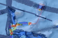
 ROV Dive Tracks - Okeanos Explorer
This feature layer provides 2D and 3D visualizations of dive tracks as observed by remotely operated vehicle (ROV) Deep Discoverer operated by NOAA Ship Okeanos Explorer (2013-present).
Type: Feature Service
Last Modified: February 2, 2024
 Off Road Vehicle Tracks
Off road vehicle tracks in the Canterbury Region.
Type: Feature Service
Last Modified: March 27, 2017
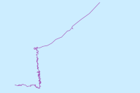
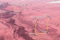
 Autonomous Vehicle Track - Year One
Autonomous Vehicle Track - Year One
Type: CityEngine Web Scene
Last Modified: July 20, 2022
 ROV Dive Tracks 3D Scene
This web scene provides 3D visualizations of ROV Deep Discoverer dives operated by the NOAA Ship Okeanos Explorer (2013-present).
Type: Web Scene
Last Modified: January 30, 2023
 FGBNMS_ROV_Tracks
Tracks from remotely operated vehicle dives by Flower Garden Banks National Marine Sanctuary, 2001 - 2019
Type: Feature Service
Last Modified: March 2, 2021
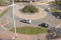 Vehicle detection and tracking using deep learning
Use deep learning to track vehicles
Type: Notebook
Last Modified: April 18, 2024
 Okeanos Explorer - Live Operations Map
A web map providing near-real-time information about NOAA Ship Okeanos Explorer’s current location, current meteorological information, current expedition's ship track, and daily bathymetric products.
Type: Web Map
Last Modified: January 30, 2024
 ROV Samples - ROV Deep Discoverer
This hosted feature layer details where both biological and geological samples were collected by ROV Deep Discoverer from 2015-present.
Type: Feature Service
Last Modified: January 30, 2023
 vehicle_tracks_view_only
Real-Time Vehicle Tracks (View Only)
Type: Feature Service
Last Modified: November 7, 2021


