A web map that allows public safety to submit redlines or markups when they find errors on the wall map and run book.
CrawlThis basic capability is served well by working with a local GIS department that serves Public Safety to create maps or map books that Public Safety personnel can ‘mark up’ or ‘redline’ and return to the GIS Unit for editing. This is a paper-based process, but a reliable one that does require some tracking and management of the edits to assure that the edits that have been requested have been resolved. |
WalkThe next step in the maturation of this process comes when the local GIS Unit that serves public safety creates an online mapping service that is made available to Public Safety personnel along with the ability to look up addresses and print maps. The printed maps can be taken to the field, marked up with proposed changes, and returned to the Station. Upon return, the GIS Unit can QA/QC the changes and update the data (addresses, street names, etc.). |
RunA mature implementation of this functionality provides web services and mobile web mapping that allows Public Safety personnel modify and correct data they find in error, from a field/mobile app. These mobile corrections are written directly into the source geodatabase and flagged as field edits. The Public Safety Agency or thier designated GIS support (in some cases, even the field personnel themselves) can mark these updates as approved and the data is transferred to the master dataset itself. This is a completely paperless process. |
| Example: Pre-Incident Plan | Example: Create a Pre-Incident Plan Map | Example: Fire Mapping Blog |
More Resources
 Pre-Incident Planning
Pre-Incident Planning can be used to inventory fire pre-incident plans and understand hazards and risks that affect responding personnel and building occupants.
Type: Solution
Last Modified: March 6, 2024
 Pre-Incident Plan Manager
An ArcGIS Experience Builder app used by pre-incident plan program managers to organize pre-incident plans and manage routine site visits that help improve fire operations in your community.
Type: Web Experience
Last Modified: October 31, 2022
 Pre-Incident Plan Manager
An ArcGIS Experience Builder app used by pre-incident plan program managers to organize pre-incident plans and manage routine site visits that help improve fire operations in your community.
Type: Web Experience
Last Modified: April 7, 2023
 Pre-Incident Planning
Pre-Incident Planning can be used to inventory fire pre-incident plans and understand hazards and risks that affect responding personnel and building occupants.
Type: Solution
Last Modified: November 8, 2023
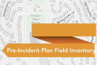 Pre-Incident Plan Field Inventory
Pre-Incident Plan Field Inventory is a configuration of Collector for ArcGIS that can be used by fire personnel to collect hazards, equipment, and supplies, needed to deal with a potential incident.
Type: Web Map
Last Modified: September 12, 2023
 Pre-Incident Plan Manager
An ArcGIS Experience Builder app used by pre-incident plan program managers to organize pre-incident plans and manage routine site visits that help improve fire operations in your community.
Type: Web Experience
Last Modified: March 13, 2024
 Pre-Incident Plan Manager
An ArcGIS Experience Builder app used by pre-incident plan program managers to organize pre-incident plans and manage routine site visits that help improve fire operations in your community.
Type: Web Experience
Last Modified: April 16, 2024
 Pre-Incident Planning
Pre-Incident Planning can be used to inventory fire pre-incident plans and understand hazards and risks that affect responding personnel and building occupants.
Type: Solution
Last Modified: January 22, 2024
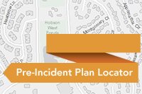 Pre-Incident Plan Locator
A map used in the Pre-Incident Plan Locator application to locate pre-incident plans and related fire protection assets near a given location.
Type: Web Map
Last Modified: September 13, 2022
 Pre-Incident Planning
Pre-Incident Planning can be used to inventory fire pre-incident plans and understand hazards and risks that affect responding personnel and building occupants.
Type: Solution
Last Modified: April 19, 2024


