A small-scale large format wall map for a driver to get a quick view of the location of the call and route.
CrawlThe Fire Station Wall Map can be used to create wall maps for your fire stations. It is a map document that is used to produce large-format, hardcopy wall maps for each fire response service area. These wall maps are typically mounted (or hung) on a fire house wall and visible to fire service professionals as they leave the station on a run. |
WalkThis is a standard, pre-configured map document contains a multi-scale basemap optimized for fire response activities. It also contains operational layers such as water hydrants, fire map index grid, fire response areas and restrictions to fire service vehicle navigation. |
RunThe map can be used to produce a single station wall map or with the Data Driven Pages toolbar to produce a wall map for each fire station response area in your community. |
| Example: Intro to Fire Station Wall Map | Example: Create a Fire Station Wall Map | Example: Create a Fire Station Wall Map |
More Resources
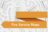
 Fire Service Maps
Fire Service Maps can be used to produce wall maps and run books that are placed in a fire station or apparatus to assist with response activities.
Type: Solution
Last Modified: March 6, 2024
 Fire Service Maps
Fire Service Maps can be used to produce wall maps and run books that are placed in a fire station or apparatus to assist with response activities.
Type: Solution
Last Modified: August 9, 2022
 Fire Service Maps
Fire Service Maps can be used to produce wall maps and run books that are placed in a fire station or apparatus to assist with response activities.
Type: Solution
Last Modified: November 8, 2023
 Fire Service Maps
Fire Service Maps can be used to produce wall maps and run books that are placed in a fire station or apparatus to assist with response activities.
Type: Solution
Last Modified: January 22, 2024
 Fire Service Maps
Fire Service Maps can be used to produce wall maps and run books that are placed in a fire station or apparatus to assist with response activities.
Type: Solution
Last Modified: April 15, 2024
 Fire Service Maps
Fire Service Maps can be used to produce wall maps and run books that are placed in a fire station or apparatus to assist with response activities.
Type: Solution
Last Modified: April 15, 2024
 Fire Service Maps
Fire Service Maps can be used to produce wall maps and run books that are placed in a fire station or apparatus to assist with response activities.
Type: Solution
Last Modified: January 30, 2024
 Fire Service Maps
Fire Service Maps is a configuration of ArcGIS Pro that can be used by mapping technicians to create station wall maps and run books for each fire response district.
Type: Project Package
Last Modified: May 23, 2018
 Fire Service Maps
Fire Service Maps can be used to produce wall maps and run books that are placed in a fire station or apparatus to assist with response activities.
Type: Solution
Last Modified: May 29, 2021
 Fire Service Maps
Fire Service Maps can be used to produce wall maps and run books that are placed in a fire station or apparatus to assist with response activities.
Type: Solution
Last Modified: December 1, 2021


