Data from the field comes in many forms. Direct intel from people who have returned from the field and convey what they have observed, GPS tracks that can be downloaded, and location-enabled devices or GIS users in the field with devices capable of capturing information and transferring it back to command and control elements.
CrawlUsing GIS Standard Operating Procedures (SOPs), incident mapping is created in paper form and users returning from the field communicate with Incident Staff what is happening and the information is digitized and updated in the next publication of the Incident Briefing Map. |
WalkThe next step in the evolution of this information management is to incorporate data into the GIS and mapping that has been captured by GPS in the field. Instead of field users marking up maps for digitization, they often return with GPS data that is downloaded by Incident Staff and incorporated directly into the incident GIS for evaluation. |
RunA mature implementation of this functionality provides web services and mobile web mapping that allows Public Safety personnel modify and correct features in the field, from a field/mobile app. These mobile corrections are written directly into the source geodatabase and flagged as field edits. The GIS Specialists at the incident can mark these updates as approved and the data is transferred to the master dataset itself. This is a completely paperless process. |
| Example: Incident Mapping | Example: Search Field Collection at ArcGIS Online | Example: Search Field Collection at ArcGIS Online |
More Resources
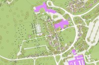
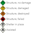 EXERCISE ONLY (1.3) - First Responder Field Data Collection Feature Layer View
***Exercise Only*** View of the feature layer created by the 2018 Winter Wrath Field Data Collection form that is based on the Phase II SAR Field Data Collection Prototype Form v3.0c. This layer is not editable.
Type: Feature Service
Last Modified: May 30, 2019
 Collector for ArcGIS (Windows)
Use maps anywhere to ground truth your data, make observations, and respond to events.
Type: Mobile Application
Last Modified: November 7, 2019
 Data Collection using Field Maps App
Data collection using a Garmin unit, phone, and ESRI Applications
Type: Web Map
Last Modified: July 14, 2021
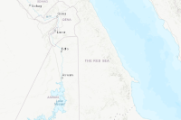
 FCC Broadband Data Collection June 2023
The Broadband Data Collection (BDC) shows fixed broadband availability for every Census Block and H3 Resolution-8 hexagonal area in the U.S. and outlying territories. This layer summarizes the June 2023 BDC data showing the number of served, underserved, and unserved Broadband Serviceable Locations (BSLs) by transmission technology in a given geography. It is a composite of six sublayers – State, County, Tract, Block Group, Block, and H3 Resolution-8 hexagonal areas – each with a related table listing all Internet Service Provider (ISP) offerings by technology and speed tier.
Type: Feature Service
Last Modified: January 3, 2024
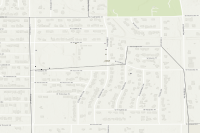
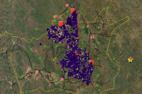
 Field Data Collection MERC 23
The following map gives an overview of field-collected GPS data points to understand the location, attributes, and proximity of wells ancd cesspits in the study area of Al Auja and Marj el Ghazal.
Type: Web Map
Last Modified: January 5, 2024
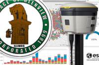 2019 - Glenview Field Collection Ops Dashboard
Village of Glenview Field Collection Operations Dashboard for the 2019 GPS Utility Collection Project.
Type: Dashboard
Last Modified: November 27, 2019
 Shared Spatial datasets Field Data Collection
Shared Spatial Datasets for Project Planning
Type: Web Map
Last Modified: February 2, 2021

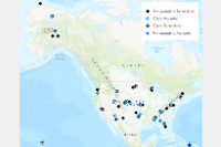 NEON Field Sites - Open Data Maps
81 terrestrial and aquatic field sampling locations across 20 ecoclimatic domains.
Type: Feature Service
Last Modified: April 15, 2024
 Planting Fields Arboretum Trees and Woody Plants
Planting Fields Arboretum is home to many collections of woody plants from around the world. Explore the interactive map to learn more about individual specimens.
Type: Web Map
Last Modified: February 5, 2019


