March 15, 2020
Last Updated: 1:45pm EDT 04/21/2020
NAPSG Foundation is compiling publicly accessible COVID-19 geospatial and situational awareness resources from a variety of sources for the purpose of providing a clearinghouse of resources that may be helpful to the public safety and GIS/technology community in responding to COVID-19. This page will be updated as new resources become available.
Power of Partnerships in Data & Technology for COVID-19 Response
Pandemic GIS Task Force Launched
NAPSG Foundation, the National States Geographic Information Council (NSGIC), and the Urban and Regional Information Systems Association (URSIA) have joined forces to provide unified leadership in advancing the use of location-based data, technology, and information sharing for pandemic preparedness and response. The three national organizations have launched a Pandemic GIS Task Force that will be leading the development of a national strategy and plan of action to enable intelligence-led pandemic preparedness and response through the use of GIS data, technology, and information sharing.
National Inventory of Health/Medical Capability Data Feeds
We are requesting the geospatial community to participate in a nationwide effort to build an inventory of existing data feeds for health/medical capability reporting in support of COVID-19 – and for increasing public health data preparedness in the future.
- Complete the Inventory Form: https://arcg.is/1XjG0S
Click here for additional information on this effort.
FEMA Resources for Emergency Response & Management Community
 FEMA Launches COVID-19 Geospatial Resource Center
Federal, State, Local, Tribal, and NGO partners responding to COVID-19 can now share authoritative data, maps and apps with the emergency management community through the new FEMA COVID-19 Geospatial Resource Center. This site facilitates geospatial authoritative data sharing, collaboration, and situational awareness. You can contribute to this nationwide effort to collect data, apps, and maps. Your contributions will ensure decision-makers at every level of government have the information they need to allocate resources and plan for their communities.
Free Access to GIS Software
State, local, tribal, and territorial government entities can now obtain free access to Esri software for up to 6 months to help respond to COVID-19. To take advantage of this opportunity, choose “Request Assistance” in the red banner, and then select “COVID-19 Response Package.”
COVID-19 State-Level Geospatial Resources
Use the interactive map below to access publicly available state-level GIS viewers and dashboards made available to support COVID-19 response. Additional state-level resources will be added to this map as they become available.
- View map in full screen: https://arcg.is/1X8vqC
- If you have an official state-level map or dashboard to add to the map, please send it to tlawson@publicsafetygis.org
COVID-19 Resources for Law Enforcement, Fire Service, and EMS
 Police: The National Police Foundation is compiling the most relevant and authoritative guidance for police and law enforcement agencies on COVID-19. They have also launched the Law Enforcement COVID-19 Personnel Impact & PPE Survey and Dashboard, which are intended for participation by police and law enforcement agencies nationwide.
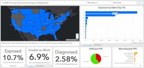
Sheriffs: The National Sheriff’s Association has launched the Sheriff’s COVID-19 Personnel Impact & PPE Questionnaire and Dashboard to support all sheriffs nationwide. View the Sheriff Impact & PPE Dashboard.
 Fire & EMS: The International Association of Fire Chiefs (IAFC) has compiled critical resources and guidance to aid fire and EMS agencies in preparing for and responding to occurrences of COVID-19. Additionally, the IAFC is collecting regular reports on COVID-19 impact from fire and EMS departments and providing real-time analysis on impact.
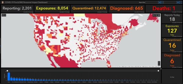
- Fire & EMS Personnel Impact Dashboard and Questionnaire
- Fire & EMS PPE Needs Dashboard and Questionnaire
Expanded Access to HIFLD Licensed Data Now Available
 As Emergency Management and Homeland Security Mission Partners respond to the COVID-19 outbreak, all applicable licensed datasets have been released to local, tribal, and territorial users with COVID-19 operational needs. This expanded access covers these additional data products:
- Licensed Parcel Data
- 2020 Roads and Routing Dataset
- Dun & Bradstreet Business Points Data
Link to more information and access: https://www.napsgfoundation.org/hifld_covid19/
Access the Esri COVID-19 GIS Hub
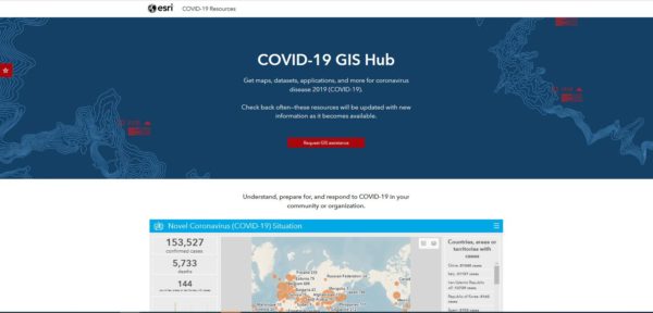 On the COVID-19 GIS Hub, you will find valuable and ready-to-use demographics and other data from the best available sources, the user community, and business partners. You will also find practical apps that immediately aid better understanding and decision-making. This includes a collection of datasets, applications, and other useful content for your planning and response. These materials will be updated with new content as it becomes available.
Link to COVID-19 GIS Hub: https://coronavirus-resources.esri.com/
Esri Solutions for Public Health COVID-19 Response
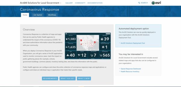 Public Health agencies can configure and share the entire collection of Coronavirus response maps and applications, or configure and share an individual map or application that meets their specific needs using templates provided by Esri.
- Link to Esri COVID-19 Templates: https://solutions.arcgis.com/local-government/help/coronavirus-response/
Guidance from Esri on Understanding the Potential COVID-19 Impact on Your Organization or Community
- Map the cases—Map confirmed and active cases, deaths, and recoveries to identify where COVID-19 infections exist and have occurred.
- Map the spread—Time-enabled maps can reveal how infections spread over time and where you may want to target interventions.
- Map vulnerable populations—COVID-19 disproportionally impacts certain demographics such as the elderly and those with underlying health conditions. Mapping social vulnerability, age, and other factors help you monitor at-risk groups and regions you serve.
- Map your capability to respond—Map facilities, employees or citizens, medical resources, equipment, goods, and services to understand and respond to current and potential impacts of COVID-19.
- Communicate with maps—Use interactive web maps, dashboard apps, and story maps to help rapidly communicate your situation.
Request Assistance from Esri’s Disaster Response Program
If your organization’s GIS capacity is exceeded and you need emergency support, there are several ways Esri may be able to help.
Please reach out to Esri at https://go.esri.com/e/82202/disaster/mz9mmw/732591364?h=FN11XNQ3VMisKuuXOWHet80KbndG0xE5j7iKRvHzlTw and click “Request Assistance.” And, if you have data or solutions that would be useful to others, you can share them with Esri for potential inclusion in Esri’s COVID-19 GIS Hub and make them accessible to the global community.


