Resources
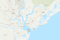
 Maryland Ecosystem Services - Flood Prevention and Stormwater Mitigation Potential Economic Value - dollars per year
Maryland Ecosystem Services - Flood Prevention and Stormwater Mitigation Potential Economic Value - dollars per year
Type: Feature Service
Last Modified: August 27, 2019
 SACS_Tier2_FC_DL_EAD
The SACS Census Blocks are a subset of the 2019 US Census TIGER/line census blocks GIS data within the SACS Study Area that experience economic damages from coastal storm surge inundation as determined by FEMA’s HAZUS-MH tool in the CONUS portion of the study area, and the FEMA Flood Assessment Screening Tool (FAST) in OCONUS portion of the study area. Census Blocks are statistical areas bounded by visible features (e.g., streets, roads, streams, and railroad tracks, and by nonvisible boundaries, such as selected property lines and city, township, school district, county limits, and short line-of-sight extensions of streets and roads.
Type: Feature Service
Last Modified: January 17, 2024
 SACS_Tier2_EC_DL_EAD
The SACS Census Blocks are a subset of the 2019 US Census TIGER/line census blocks GIS data within the SACS Study Area that experience economic damages from coastal storm surge inundation as determined by FEMA’s HAZUS-MH tool in the CONUS portion of the study area, and the FEMA Flood Assessment Screening Tool (FAST) in OCONUS portion of the study area. Census Blocks are statistical areas bounded by visible features (e.g., streets, roads, streams, and railroad tracks, and by nonvisible boundaries, such as selected property lines and city, township, school district, county limits, and short line-of-sight extensions of streets and roads.
Type: Feature Service
Last Modified: January 17, 2024
 SACS_Tier2_FC_Risk
The SACS Census Blocks are a subset of the 2019 US Census TIGER/line census blocks GIS data within the SACS Study Area that experience economic damages from coastal storm surge inundation as determined by FEMA’s HAZUS-MH tool in the CONUS portion of the study area, and the FEMA Flood Assessment Screening Tool (FAST) in OCONUS portion of the study area. Census Blocks are statistical areas bounded by visible features (e.g., streets, roads, streams, and railroad tracks, and by nonvisible boundaries, such as selected property lines and city, township, school district, county limits, and short line-of-sight extensions of streets and roads.
Type: Feature Service
Last Modified: January 17, 2024
 HAZUS 100-Year Flood Economic Loss - HMP 2024
Economic loss calculations from 100-year flood NYC HAZUS run. Created for the 2024 Hazard Mitigation Plan update.
Type: Feature Service
Last Modified: January 4, 2024
 SACS_Tier2_EC_Risk
The SACS Census Blocks are a subset of the 2019 US Census TIGER/line census blocks GIS data within the SACS Study Area that experience economic damages from coastal storm surge inundation as determined by FEMA’s HAZUS-MH tool in the CONUS portion of the study area, and the FEMA Flood Assessment Screening Tool (FAST) in OCONUS portion of the study area. Census Blocks are statistical areas bounded by visible features (e.g., streets, roads, streams, and railroad tracks, and by nonvisible boundaries, such as selected property lines and city, township, school district, county limits, and short line-of-sight extensions of streets and roads.
Type: Feature Service
Last Modified: January 17, 2024
 Total Economic Loss modeled by FEMA-HAZUS for 1% annual chance flood.
Total Economic Loss modeled by FEMA-HAZUS for 1% annual chance flood.
Type: Web Map
Last Modified: April 11, 2022
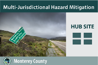 County of Monterey Multi-Jurisdictional Hazard Mitigation
Public hub site for the Monterey County Multi-Jurisdictional Hazard Mitigation Plan (MJHMP), maintained by the Office of Emergency Services.
Type: Hub Site Application
Last Modified: October 8, 2020
 LMS - Local Mitigation Strategy Dashboard
Local Mitigation Strategy (LMS) Dashboard - Miami-Dade County and Municipalities
Type: Dashboard
Last Modified: December 29, 2023
 Local Mitigation Strategies - Web Map For Dashboard
Local Mitigation Strategies web map for Dashboard
Type: Web Map
Last Modified: December 29, 2023


