The National Alliance for Public Safety GIS (NAPSG) Foundation invites you to attend a free, one-day flood workshop in Baton Rouge, LA, on January 18, 2017. Lunch will be provided.
Our Goal: To address the need for timely, reliable, and accessible sources of current operational and preparedness information to support local decision making for flooding events.
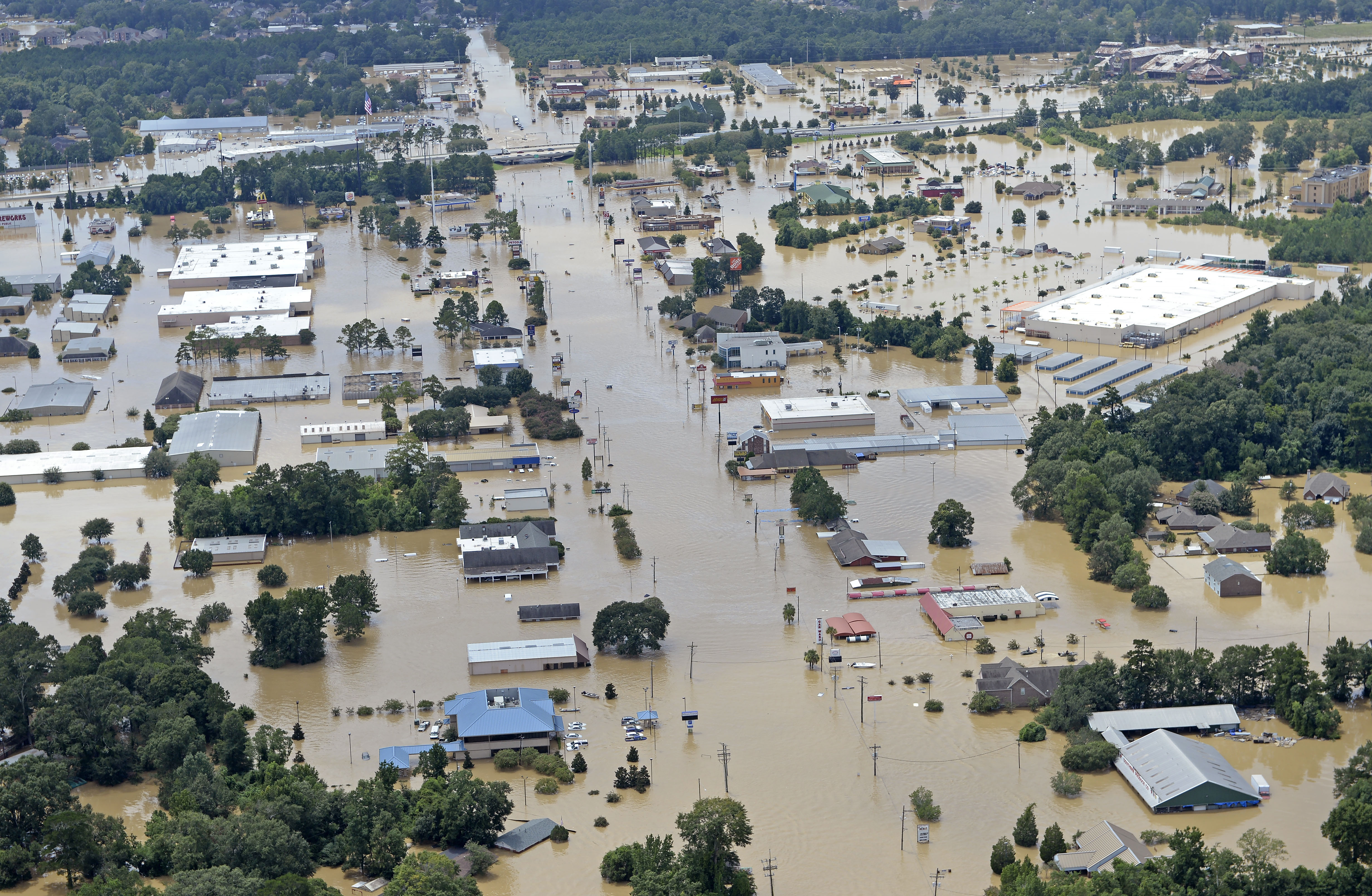
The Denham Springs area during severe flooding in Livingston Parish on Sunday August 14, 2016. Image by Bill Feig.
You will join first responders and public safety officials, as well as geospatial professionals, from around the region to identify, document, and prioritize the critical decision points of the first responder community during a flood disaster. Recent flooding events in the area provide us an opportunity to reflect on the decisions that had to be made in difficult circumstances and to better prepare for the next disaster.
This is a small, discussion-oriented workshop that is limited to 50 people in order to capture actionable outcomes from the event. Your input and perspective on flooding response will help ensure the correct information is captured and documented for the development of a national flood preparedness guideline, as well as for local preparedness efforts in the region.
We hope you can join us on January 18, 2017, in Baton Rouge!
– NAPSG Foundation
Featured Speakers

Joe Thompson
Chief Applications Administrator
East Baton Rouge Parish Communications District

Jack Varnado
Captain, Communications
Livingston Parish Sheriff’s Office

Chris Cretini
Geospatial Liaison
U.S. Geological Survey (USGS)

Barry Keeling
Undersecretary
Louisiana Department of Transportation and Development

Brent Yantis
Director
NASA/UL Lafayette Regional Application Center


