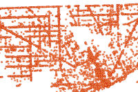
Comprehensive use of data to support analysis focused on understanding of hazards and risk in the community. This information is used for understanding the drivers for incidents in the community. Understanding where hazard and risk occur drive specific patterns in mitigation, preparedness, response, and ulitimately the resillience in the community.
CrawlMaps of hazards in a community that are shared with all stakeholders – first responders, emergency managers and the public. These maps are used to inform the public and decision makers to at least a basic undrstanding of the Hazard. They can be used to differentiate between Hazard and Risk. |
WalkAutomated analysis tasks that can be initiated by a GIS professional supporting a Public Safety Agency |
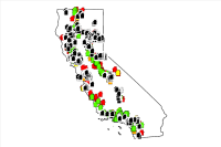
RunFully integrated community risk that includes analysis for calls, patterns, causes and drivers of hazard and risk in a community. This analysis is geared towards all levels of the organization and is designed to inform planning, mitigation, response and recovery strategies and deployment patterns. |
| Example: Denver County Multi-Hazards Risk Assessment | Example: The Next Step for Homeland/National Security | Example: Tualatin Valley Fire & Rescue |
More Resources
 Fire Inspections
Annual Life Safety Fire Inspections conducted by the Detroit Fire Department (DFD) Fire Marshall Division.
Type: Feature Service
Last Modified: April 23, 2024
 Fire Prevention Inspection Areas
Fire inspection areas administered by City of Boise Fire Department.
Type: Feature Service
Last Modified: April 29, 2024
 CAL FIRE Damage Inspection (DINS) Data
CAL FIRE Damage Inspection Program (DINS) database of structures damaged and destroyed by wildland fire in California since 2013 as documented by CAL FIRE and partnering agencies. Structures damaged by fire prior to 2013 do not have a digital record. Fires in LRA or FRA responsibility areas may or may not be included. Beginning in 2018 the DINS Program collected all non-damaged structures, prior to 2018 only damaged/destroyed structures were collected. Data included: 2013-2022.
Type: Feature Service
Last Modified: September 6, 2023
 Fire Hydrant Inspections
Fire Hydrant Inspections can be used to perform routine fire hydrant inspections and monitor fire department hydrant inspection programs that ensure every hydrant performs reliably when an emergency occurs.
Type: Solution
Last Modified: March 6, 2024
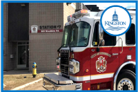 Fire Inspection Areas
This service contains the labels and jurisdictional boundaries for City of Kingston (Kingston Fire & Rescue) Fire Prevention Officers.
Type: Feature Service
Last Modified: February 9, 2024
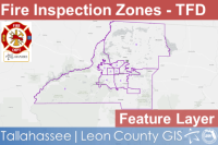 Fire Inspection Zones - TFD
This polygon feature layer displays Fire Inspection Zone Boundaries for Tallahassee and Leon County, Florida as provided Tallahassee Fire Department and the Consolidated Dispatch Agency.
Type: Feature Service
Last Modified: February 29, 2024
 1.14 High Risk Fire Inspections (summary)
Data for the High Risk Fire Inspections performance measure.
Type: Feature Service
Last Modified: February 1, 2024
 Fire Hydrants
The location of fire hydrants and detailed inspection information.
Type: Layer Template
Last Modified: August 25, 2023
 Fire Hydrant Inspections
Fire Hydrant Inspections can be used to perform routine fire hydrant inspections and monitor fire department hydrant inspection programs that ensure every hydrant performs reliably when an emergency occurs.
Type: Solution
Last Modified: January 22, 2024
 Fire Hydrant Inspections
Fire Hydrant Inspections can be used to perform routine fire hydrant inspections and monitor fire department hydrant inspection programs that ensure every hydrant performs reliably when an emergency occurs.
Type: Solution
Last Modified: November 8, 2023


