Mapping Hazardous Materials and supporting analysis of routing, treatment, storage, disposal and releases is a powerful use of GIS in Public Safety. This analysis supports safety and allows users to identify EPA ID numbers, placards, locations, names, addresses, County/DEC region, handling method, and quantities received.
CrawlMapping Hazardous material storage locations, transportation routes and chemical and quantity information is the foundation of HazMat Analysis. Tracking and inspecting these payloads promotes community safety and Public Safety responsibility. A good start is mapping the HazMat reportable quantity sites in your jurisdiction along with dates of last inspection. A good addition to these hard copy maps are approved HazMat transportation corridors through the community. |
WalkThe next step in Hazardous Material Analysis and Tracking is to integrate the inspection, location, and route information into an online map format to be shared internally to your agency and with your (approapriate) partner agencies. Focus here should be on timely reporting and status of HazMat transportation and storage as well as integrating Agency information with similar information in neighboring jurisdictions. |
RunExtending the HazMat online/dynamic mapping to incident support is the next step. Creating systems that HazMat Teams can reference when responding to incidents is the key. Additionally, providing an ‘upload’ capability that allows a HazMat team to run a plume model (like CAMEO/ALOHA) and upload the results into the web mapping allow other First Responders to see the current release information in order to facilitate incident safety, the public safety, and securing of the scene. |
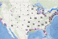
| Example: US Hazardous Material Routes | Example: US Hazardous Material Routes | Example: Plume Spread Map |
More Resources
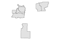
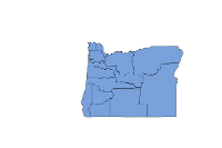 HazMat Team Boundaries
This dataset provides geographic boundries for the State of Oregon's Hazmat Response Teams.
Type: Feature Service
Last Modified: March 30, 2023
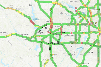
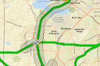 White Settlement HazMat Hazard Situational Awareness Exercise
White Settlement, TX situational awareness map for a HazMat incident exercise.
Type: Web Map
Last Modified: August 20, 2018
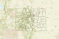
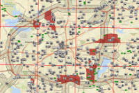 Tarrant Co. HazMat Hazard Assessment
Assessment of a large, roadway HazMat incident and the vulnerable populations that would be affected, in Tarrant County, TX.
Type: Web Map
Last Modified: August 5, 2018
 Tarrant County HazMat Hazard Assessment with Presentation
Assessment of a large, roadway HazMat incident and the vulnerable populations that would be affected, in Tarrant County, TX.
Type: Web Map
Last Modified: July 15, 2018
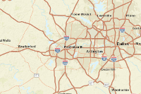
 Tarrant County Areas Susceptible to a HazMat Hazard
This is an impact summary for the highly vulnerable areas related to a potential HazMat spill.
Type: Web Mapping Application
Last Modified: August 19, 2018
 HazMat Spill Public Information
Web app designed to share information with the public about the areas most vulnerable in a HazMat spill incident.
Type: Web Mapping Application
Last Modified: August 18, 2018
 HAZMAT Threats
Identification of potential HAZMAT threats to more at risk locations.
Type: Web Map
Last Modified: December 2, 2018
 HazMat Rail Plans
Counties, and combinations of counties which have a HazMat by Rail Emergency Response Plan.
Type: Feature Service
Last Modified: April 27, 2023
 Hazmat City Requirements for Gas/Diesel/Liquefied Petroleum Gas
Cities that requires gasoline, diesel, and liquefied petroleum gas to comply with routing requirements
Type: Feature Service
Last Modified: March 14, 2024
 HazMat Spill Public Information Map
Public information map depicting the areas most vulnerable to a toxic waste spill on the roadway.
Type: Web Map
Last Modified: August 17, 2018


