Resources
 Supply Chain Network Analytics with Knowledge Graphs
ArcGIS Knowledge and Rebirth Analytics
Type: StoryMap
Last Modified: April 24, 2024
 Demand_Nodes
Approximate number and location of grocery stores in the Pacific Northwest for supply chain analysis and resilience planning.
Type: Feature Service
Last Modified: September 26, 2022
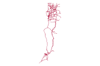 Supply Chain (Westport Long List)
Contains the proposed and existing transportation connections for each port option in the Westport MCA1 Long List.
Type: Feature Service
Last Modified: August 17, 2020
 WI Solar Supply Chain Map
The WI Solar Supply Chain Map includes companies involved in all aspects of the solar industry. For a searchable directory of these companies visit: www.shwbc.org
Type: Web Map
Last Modified: June 13, 2013
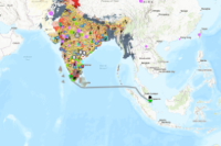
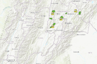 Perfectos Supply Chain
Visual analysis of Perfectos supply chain nodes in South America
Type: Web Map
Last Modified: April 29, 2021
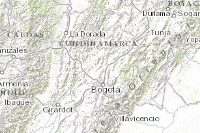 Perfectos Supply Chain
Visual analysis of Perfectos supply chain nodes in South America
Type: Web Map
Last Modified: March 12, 2020
 CitizenProblems_Financial_Supply_Chain_Management
Problems reported by general public through focused citizen engagement applications. Financial Services - Supply Chain Management
Type: Feature Service
Last Modified: August 5, 2021
 The Reach of Supply Chain Management
Type: Web Mapping Application
Last Modified: October 28, 2015
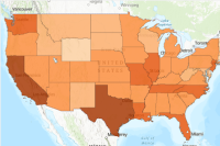 National Risk Index States Expected Annual Loss
The National Risk Index States Expected Annual Loss feature layer contains state-level data for Expected Annual Loss. County-level Expected Annual Loss data were aggregated to produce this state-level dataset. The National Risk Index is a dataset and
Type: Web Map
Last Modified: December 1, 2023
 Chili_Supply_Chain_Data
Data associated with the chili supply chain demo.
Type: Feature Service
Last Modified: December 15, 2022


