Resources
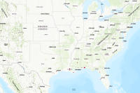
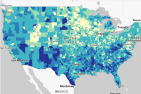 FEMA Community Resilience Challenges Index (CRCI) Counties
Counties - FEMA Community Resilience Challenges Index (CRCI) - Percentile: Composite of 22 CRCI Indicators
Type: Feature Service
Last Modified: May 17, 2023
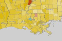
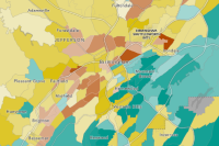
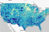 FEMA Community Resilience Challenges Index (CRCI) Census Tracts
This layer of census tracts contains the FEMA Community Resilience Challenges Index (CRCI) information. The layer displays the CRCI Percentile, which is a composite of 22 CRCI indicators.
Type: Feature Service
Last Modified: May 17, 2023
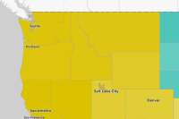
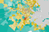 Community Resilience Estimates & Equity Supplement 2022: Census Tracts
The Community Resilience Estimates (CRE) provides an easily understood metric for how socially vulnerable every neighborhood in the United States is to the impacts of disasters. Contains estimates for the nation, states, counties, and tracts.
Type: Feature Service
Last Modified: March 11, 2024
 FEMA Community Disaster Resilience Zones
Users of the FEMA Community Disaster Resilience Zones data will be able to identify where Community Disaster Resilience Zones exist. This layer was created by FEMA Headquarters to target Census tracts identified as disadvantaged communities most at-risk to natural hazards as a part of the Community Disaster Resilience Zones Act.
Type: Feature Service
Last Modified: April 4, 2024
 GMD Community Resilience Projects
This layer contains EPA Gulf of Mexico Division's active cooperative agreements with a primary focus area of community resilience.
Type: Feature Service
Last Modified: August 2, 2022
 Community Resilience Estimates & Equity Supplement 2022: Counties
The Community Resilience Estimates (CRE) provides an easily understood metric for how socially vulnerable every neighborhood in the United States is to the impacts of disasters. Contains estimates for the nation, states, counties, and tracts.
Type: Feature Service
Last Modified: March 11, 2024
 Community Resilience Estimates & Equity Supplement 2022: States
The Community Resilience Estimates (CRE) provides an easily understood metric for how socially vulnerable every neighborhood in the United States is to the impacts of disasters. Contains estimates for the nation, states, counties, and tracts.
Type: Feature Service
Last Modified: March 11, 2024
 Community Resiliency Fund Grant Program Area
ARPA Funding Eligibility. Per Treasury guidelines, the city of Charlotte has developed a fact-specific proxy to determine eligible geographic areas for residents served by ARPA funding for water bill payments (Charlotte Water) and the Community Resiliency Fund (Housing & Neighborhood Services). Eligible areas include census tracts with household income below 80% Area Median Income, as determined by 2020 ACS 5 year Estimates.
Type: Feature Service
Last Modified: May 17, 2023
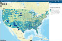 Resilience Analysis and Planning Tool (RAPT)
The FEMA and Argonne created the Resilience Analysis and Planning Tool (RAPT) to support state, local, tribal, territorial analysis in identifying focus areas for building resilience and response capabilities.
Type: Web Mapping Application
Last Modified: March 21, 2024
 Community Resilience Estimates & Equity Supplement 2021: Tracts
The Community Resilience Estimates provides an easily understood metric for how at-risk every neighborhood in the United States is to the impacts of disasters. Contains estimates for Census Tracts.
Type: Feature Service
Last Modified: March 11, 2024


