Resources
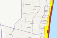
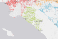
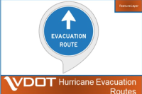 Hurricane Evacuation Routes
Commonwealth of Virginia hurricane evacuation routes.
Type: Feature Service
Last Modified: March 16, 2023
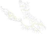
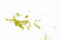 Bike Routes – SCAG Region
The SCAG Regional Bikeway Shapefile (RBS) contains proposed and existing bikeways, defined by class, within the SCAG region. The main purpose of the RBS is to be used for active transportation planning. The SCAG RBS can be used to analyze and visualize existing and proposed bikeways throughout the region and also provides guidance for reporting changes and additions to the regional bikeway network. Please note this data was reviewed by local jurisdictions and reflects each jurisdiction's input received during the SCAG's 2020 RTP/SCS Bottom-Up Local Input and Envisioning Process. The data was reviewed to ensure the status and location were consistent with the 2016 baseline conditions. Updates were shared by Ventura and San Bernardino Counties in 2020 and have been incorporated as requested.
Type: Feature Service
Last Modified: October 18, 2023
 Bike Routes - proposed – SCAG data
The SCAG Regional Bikeway Shapefile (RBS) contains proposed and existing bikeways, defined by class, within the SCAG region. The main purpose of the RBS is to be used for active transportation planning. The SCAG RBS can be used to analyze and visualize existing and proposed bikeways throughout the region and also provides guidance for reporting changes and additions to the regional bikeway network. Please note this data was reviewed by local jurisdictions and reflects each jurisdiction's input received during the SCAG's 2020 RTP/SCS Bottom-Up Local Input and Envisioning Process. The data was reviewed to ensure the status and location were consistent with the 2016 baseline conditions. Updates were shared by Ventura and San Bernardino Counties in 2020 and have been incorporated as requested.
Type: Map Service
Last Modified: March 22, 2023
 CA BNSF Crude Shipment Railroad Route
CA BNSF railroad route for crude shipments.
Type: Feature Service
Last Modified: March 17, 2015
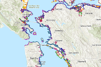 San Francisco Bay Shoreline Type
San Francisco Bay Shoreline Type for California State Lands Commission Sea-Level Rise Viewer. Data is from the San Francisco Estuary Institute.
Type: Feature Service
Last Modified: June 19, 2019
 Bike Routes – SCAG Region
Type: Web Map
Last Modified: March 19, 2024
 Public Information_WFL1
A map used in Public Information application to display authoritative information about an incident or current event.
Type: Feature Service
Last Modified: September 19, 2022
 San_Francisco_Bay_Shore_Inventory
With rising sea levels and the increased likelihood of extreme weather events, it is important for regional agencies and local municipalities in the San Francisco Bay Area to have a clear understanding of the status, composition, condition, and elevation of our current Bay shore, including both natural features and built infrastructure. The purpose of this Bay shore inventory is to create a comprehensive and consistent picture of today’s Bay shore features to inform regional planning. This dataset includes both structures engineered expressly for flood risk management (such as accredited levees) and features that affect flooding at the shore but are not designed or maintained for this purpose (such as berms, road embankments, and marshes). This mapping covers as much of the ‘real world’ influence on flooding and flood routing as possible, including the large number of non-accredited structures. This information is needed to: 1. identify areas vulnerable to flooding; 2. identify adaptation constraints due to present Bay shore alignments; and 3. suggest opportunities where beaches, wetlands, and floodplains can be maintained or restored and integrated into flood risk management strategies. The primary focus of the project is therefore to inform regional planners and managers of Bay shore characteristics and vulnerabilities. The mapping presented here is neither to inform FEMA flood designation nor is it a replacement for site-specific analysis and design. For more information about the Bay Shore mapping project, including an illustrated explanation of the dataset attributes and mapping methods please refer to: www.sfei.org/projects/SFBayShoreInventory.
Type: Feature Service
Last Modified: April 17, 2022
 Contraintes de circulation
Recensement des restrictions de circulation, liées aux transports exceptionnels : gabarit et tonnage, notamment pour la circulation des poids lourds et engins spéciaux.
Type: Feature Service
Last Modified: July 13, 2023