A data management workflow used to create pre-fire plans, etc.
CrawlPaper maps detailing site information. Often in the form of a map book containing hand or GIS or CAD drawn maps of access, water supply, hazards, and building construction features. |
WalkGIS desktop supported/created pre-incident planning. Support creation of softcopy and hardcopy map books containing preplan features. |
RunPreplanning mapping done in a fully mobile environment by field staff (firefighters, etc). This should (ideally) work on any mobile device or MDC and link directly to the geodatabase via web services. This means that creation of preplans are almost immediately available to QC or to the field. This level is often accompanied by an ArcGIS Desktop addin that allows professional GIS to QA/QC the data coming in from the field. This level also provides for Level I, II, and III preplans (general to specific levels of preplan). Contact Chris Rogers at FireMapping.com. This does not constitute an endorsement by NAPSG for any company or product. |
| Example: Fire Pre-plan Map Editor | Example: Preplan Maps at ArcGis Online | Example: Fire Mapping Blog |
More Resources
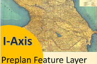 IAxis Preplan Feature Service
A feature service that contains building features for fire department based structure preplans.
Type: Feature Service
Last Modified: October 10, 2021
 Preplan_Features_SIMPLE
This is data that shows SIMPLE PREPLAN LAYERS for Eastside Fire and Rescue
Type: Feature Service
Last Modified: April 6, 2023
 Preplan
Feature service that includes preplan symbology,
Type: Feature Service
Last Modified: May 30, 2019
 NAPSG Preplan Service
These features are features that already exist are oriented to building pre-incident planning
Type: Feature Service
Last Modified: May 30, 2019
 Sites
Sites
Feature layer that contains preplan site location
Type: Feature Service
Last Modified: March 23, 2024
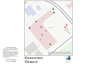
 DTHP Web App - map component
This map contains Digital Target Hazard Preplan points with links to the preplans in PDF format. This map is intended to be used by appropriate public safety personnel that are not members of the SanMAPS Regional Users Group but have the login creden
Type: Web Map
Last Modified: August 27, 2018
 Web App - Layer
Service to be used for Suburban preplan collection through Collector for ArcGIS mobile app and Suburban Preplan Data Collection Web App. Not intended to be used as a stand-alone layer or outside of the context of the Web App.
Type: Feature Service
Last Modified: July 26, 2018
 Single Preplan Feature Service
Single Preplan Feature Service for mapping structure hazards and features
Type: Feature Service
Last Modified: April 1, 2022
 PreplanBase
Feature Service that contains fire department area (FDID), Site, and Building Footprint
Type: Feature Service
Last Modified: May 28, 2023
 Preplan Map Package
These features are features that already exist are oriented to building pre-incident planning
Type: Map Package
Last Modified: May 30, 2019


