Mapping to support preparedness for response to high-risk Targeted Hazards. The definition of Target Hazards will vary between jurisdictions, but examples are critical infrastructure, high-life hazard occupancies, and places of assembly.
CrawlThe first step in this process is to adopt a definition of Target Hazards within the Public Safety jursisdiction and create a list of these locations. The list needs to be used to create a GIS layer of the site that contains the location, description, and response profile to the site. This layer will be used to create an overview map of the jurisdictions that can be posted in Emergency Operation Centers, Dispatch Centers, Law Enforcement and Fire locations for reference. |
WalkTo aid planning and response for Target Hazards, the GIS information should be made available in softcopy (PDF) and web mapping to First Responders, Emergency Management and Planning personnel. The data is helpful when visualized during the response cycle to give responders notification that they are responding to a Target Hazard or working in proximity to one. This is a basic situational awareness element. It provides an awareness of the specific nature of the hazard and may influence tactics because of the people, the occupancy, or the content of the hazard (Non-ambulatory population, HazMat, Day Care, dangerous construction, etc). |
RunTarget Hazard data that is fully integrated into the planning, response, and recovery phases of the Public Safety Agency is the goal with this phase. Data related to Target Hazards is used in planning responses to these locations. It is a component of understanding the risk to both the First Responders and the Community as well as the impact this site will have on recovery from a major incident within the community. During a response, operational resources may be augmented here based on the nature of the Target Hazard, or specialized resources may be automatically ordered (additional transport, heavy rescue, SWAT, etc). This implementation of Target Hazard data means that the data is regularly maintained by field units and that the data is included in operational planning and community risk analysis. The data is also incorporated into the most basic planning by Public Safety; engineering review, code enforcement, community outreach, Automatic and Mutual Aid agreements. |
| Example: Introduction to Target Hazard Analysis | Example: Introduction to Target Hazard Analysis | Example: Introduction to Target Hazard Analysis |
More Resources
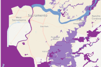 USA Flood Hazard Areas
This feature layer displays Flood Hazard Areas from the Flood Insurance Rate Map created by the Federal Emergency Management Agency.
Type: Feature Service
Last Modified: September 20, 2023
 Target Hazard Analysis
Target Hazard Analysis can be used to identify properties and buildings that could result in a loss of life, or have a negative impact on the community, if a fire were to occur.
Type: Solution
Last Modified: March 6, 2024
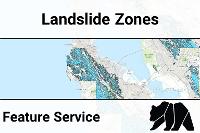 CGS Seismic Hazards Program: Landslide Zones (DOC Hosted)
The map is used by cities and counties to regulate development and by property owners selling property within areas where seismic hazard zones have been identified. Local governments can withhold development permits until geologic or soils investigations are conducted for specific sites and mitigation measures are incorporated into development plans. Sellers of property use the maps to check the location of their specific site and, if applicable, disclose to the buyer that the property lies within a seismic hazard zone as required by the Seismic Hazards Mapping Act of 1990 (Public Resources Code, Division 2, Chapter 7.8). For information regarding the scope and recommended methods to be used in conducting the required site investigations, see California Geological Survey Special Publication 117A, Guidelines for Evaluating and Mitigating Seismic Hazards in California.
Type: Map Service
Last Modified: April 11, 2022
 Target Hazard Analysis
Target Hazard Analysis can be used to identify properties and buildings that could result in a loss of life, or have a negative impact on the community, if a fire were to occur.
Type: Solution
Last Modified: August 9, 2022
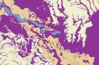 USA Flood Hazard Areas
This layer displays Flood Hazard Areas from the Flood Insurance Rate Map created by the Federal Emergency Management Agency.
Type: Image Service
Last Modified: September 27, 2023
 Target Hazard Analysis
Target Hazard Analysis can be used to identify properties and buildings that could result in a loss of life, or have a negative impact on the community, if a fire were to occur.
Type: Solution
Last Modified: January 22, 2024
 Target Hazard Analysis
Target Hazard Analysis can be used to identify properties and buildings that could result in a loss of life, or have a negative impact on the community, if a fire were to occur.
Type: Solution
Last Modified: November 8, 2023
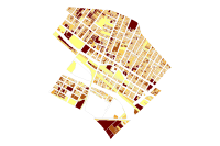 TargetHazardMap
The Target Hazard Map is used to identify locations within a community that require special response assignments and for future resource planning.
Type: Feature Service
Last Modified: August 15, 2017
 CA Tsunami Hazard Area
This Tsunami Hazard Area is prepared to assist cities and counties in identifying their exposure to tsunami hazards. It is intended for local jurisdictional, coastal evacuation planning uses only. This map and these data, and the information presented herein, are not legal documents and do not meet disclosure requirements for real estate transactions nor for any other land-use or regulatory purpose.
Type: Feature Service
Last Modified: December 1, 2022
 CA Tsunami Hazard Line
This Tsunami Hazard Line is prepared to assist cities and counties in identifying their exposure to tsunami hazards. It is intended for local jurisdictional, coastal evacuation planning uses only. This map and these data, and the information presented herein, are not legal documents and do not meet disclosure requirements for real estate transactions nor for any other land-use or regulatory purpose.
Type: Feature Service
Last Modified: December 1, 2022


