![]()
On May 28th, 2020, the FEMA Response Geospatial Office (RGO) and NAPSG Foundation hosted an Emergency Management (EM) Geo Forum about building a geospatial game plan for tornado readiness, response, and recovery.
Seminar Objectives
In this EM Geo Forum, participants:
- Learned about core information needs for tornado readiness and response.
- Gained an understanding of available tornado predictive products and their timelines.
- Learned about resources for determining and validating the scope and extent of tornado damage.
- Gained insight into how states and locals are using technology to rapidly assess impacts to inform a disaster declaration.
- Learned how to develop a Geospatial Game Plan to implement across all hazards.
Speakers
This forum featured federal staff specializing in tornado prediction and modeling and emergency management practitioners at the state / local level who are using advanced resources to aid in tornado readiness, response, and recovery.
- Paul Doherty, PhD – NAPSG Foundation
- Dr. Somer Erickson – FEMA
- Madeline Jones – New Light Technologies
- Chad Beam – State of South Carolina
- Richard Butgereit – Geospatial Intelligence Center
- Bob Buseck – Mississippi Emergency Management Agency
Seminar Resources
- Link to Recording
- Slide Deck
- Q&A One-Pager
- Tornado Geospatial Game Plan
- FEMA’s Tornado Incident Journal
- FEMA Hub Site
- FEMA Disaster Community in the GeoPlatform
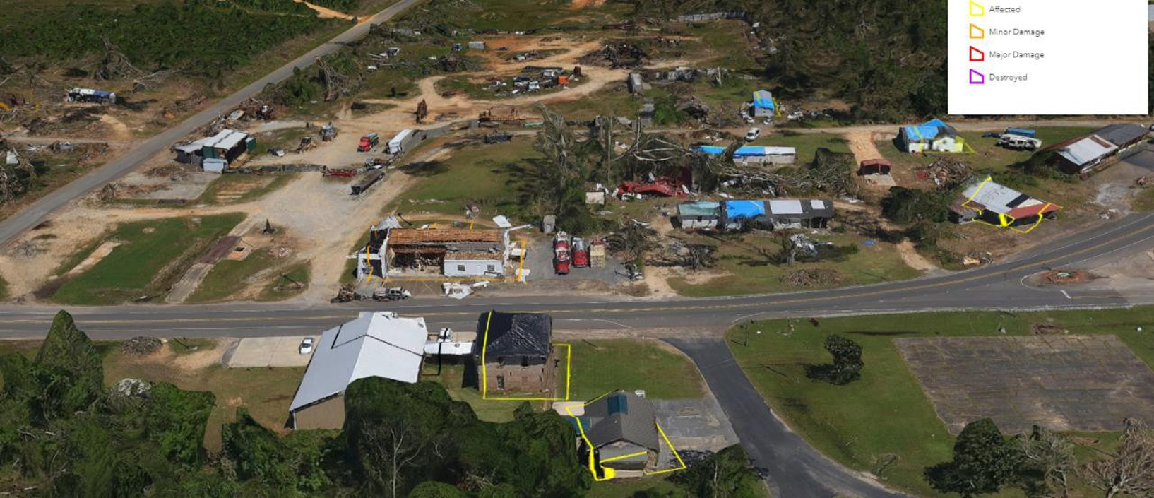
Imagery from 2020 Easter Weekend Tornado in Mississippi
Background Information
The Emergency Management (EM) Geo Forum is part of a virtual seminar series featuring best practices and resources to advance emergency management through geospatial capabilities. These seminars promote the integration of innovative technology and solutions in day-to-day operations.


