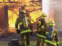
GIS is used throughout the fire service industry.
Government agencies at all levels are beginning to recognize the importance of geographic information system (GIS) technology to the public safety mission.
Creating, maintaining, and managing an effective information system are critical to the mission of a modern, effective, and efficient public safety service. This CARAT tool provides simple advice on how to build a GIS that serves the needs of public safety.
Developing a public safety GIS is an exciting journey. Use this booklet [PDF] as a road map for the ride. A GIS is an information system that understands location and can be cross-utilized by every discipline. Much more than a map, a real GIS is intelligent and interactive. Why? Because of two universal characteristics that make a GIS a unique kind of information system:

1. GIS is layer-centric:
Map projects are built with layers of data. Each of these layers can be stored in a standard relational database management system (RDBMS). In this way, a GIS combines the visual benefit of a map with the power of a database.
- Basemaps
- Roads/Infrastructure
- Land use/Land cover
- Environment
- Weather information
- Vehicle locations
2. GIS is more than a map:
In a map project, GIS sorts all these different types of data by their common geography. This is what gives GIS its unique analytic ability. Because information is normalized by a specific place on the earth, you can see relationships between otherwise disparate datasets.
- Geography integrates and organizes all kinds of data.
- Collect data once, then use it often for multiple purposes.
- GIS is a team sport.


